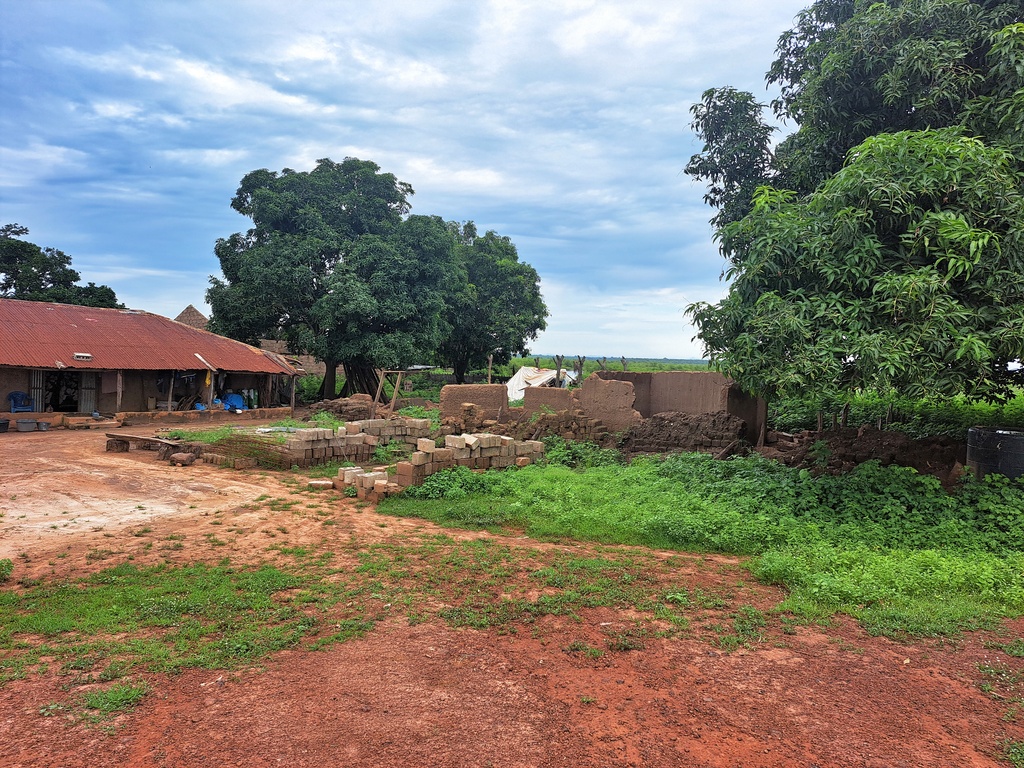
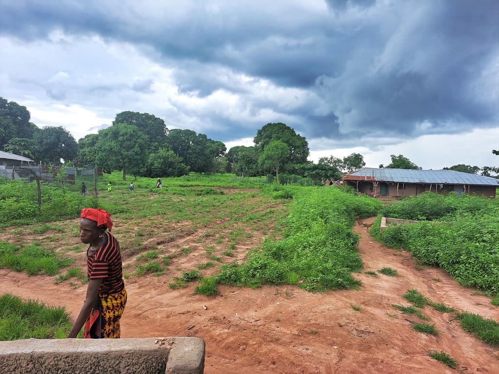
Foni Kansala- is one of the nine districts of the West Coast Region of The Gambia, located south of the Gambia River in the southwest of the country. Foni Kansala is located in the southeast of the division, between Foni Bintang-Karenai and Foni Bondali. This area of the country is prone to illegal deforestation, especially for rosewood. The area is also prone to forest fires, which has led to a shortage of fresh drinking water. According to Global Forest Watch reports, Foni Kansala district has 29.9 ha of tree cover in 2010, which is 0.21% of its land area. In 2009, it lost 75.0mha of tree cover, equivalent to 23.0t of CO2 emissions. In the Foni Kansala district, the peak fire season typically begins in mid-February and lasts approximately 12 weeks. All of these factors have made life difficult for the indigenous tribes living in the district, especially when it comes to clean drinking water. In particular, the district is dominated by the Jola tribe and a handful of Mandinka tribes.
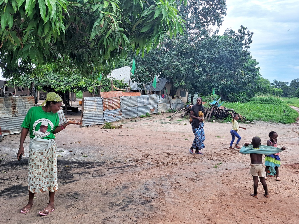
The Water for Everyone program aims to give five communities in the Foni Kansala District of the West Coast Region access to clean drinking water and improve sanitation for over 1,500 individuals, especially vulnerable women and children. We are committed to helping the people of the West Coast Region overcome their challenges and improve their quality of life.
BAJIRAN VILLAGE
GPS: N13°17.187 W015°58.203, Population: 400
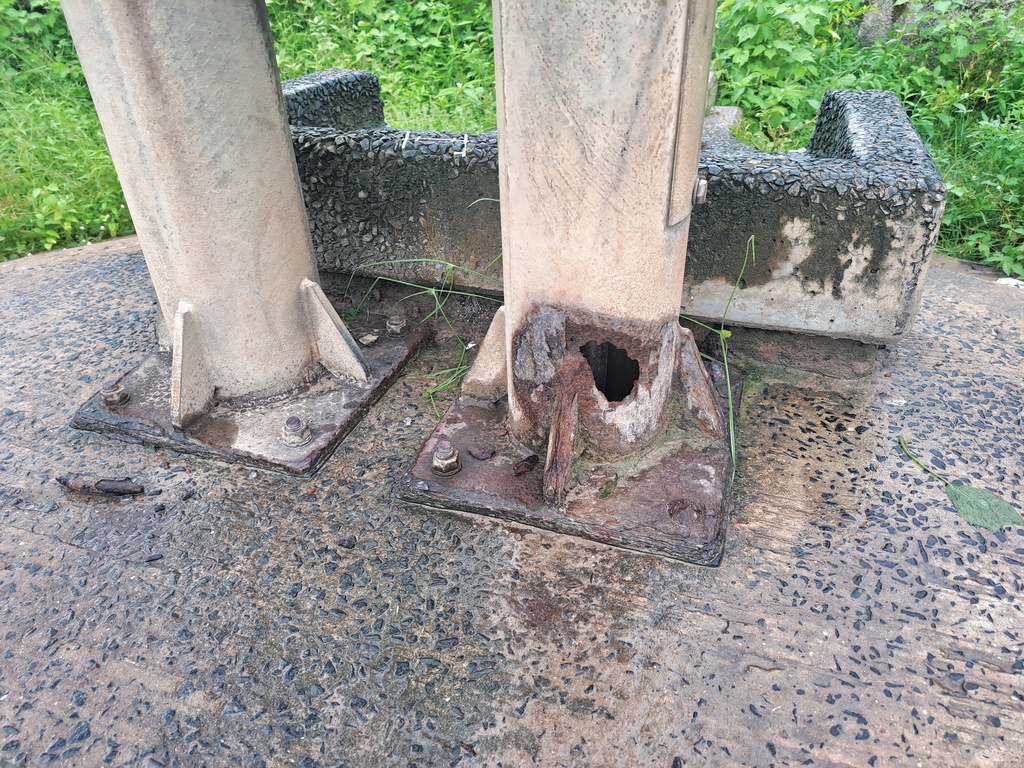
5 stainless steel pipes with rods, new conversion head, 4 culverts, check-nuts, concrete belt for the well, dewatering and sanitizing the well, hand washing station. The contractor will construct a new trough for the village ruminants to drink from, which will help the community economically.
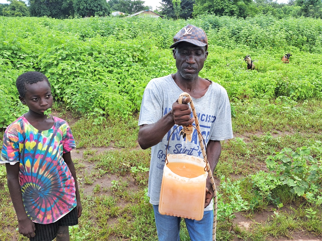
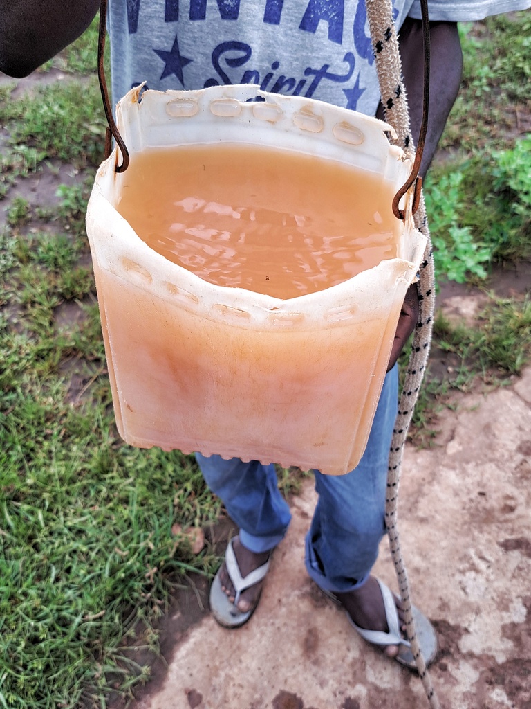
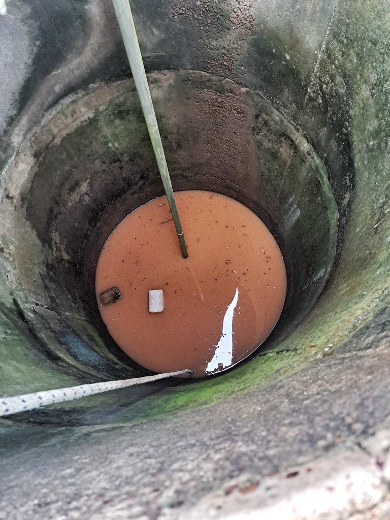
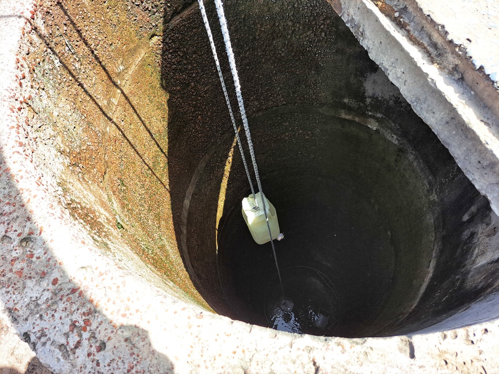
Bajiran is located about 7 KM north of the Trans-Gambia South Bank Road via Mayork. It is a community of about 400 people. The community consists mainly of the Jola tribe, with a small group of Fula herdsmen. The community’s only water source, a hand pump, has been broken for a long time. It is also infested with rodents. The villagers now use open wells as their water source. According to the public health officer stationed at the district hospital in Sibanor. The community has one of the highest rates of water-borne diseases in the district. This has a severe impact on women and children, especially those under the age of 5.
BUROCK VILLAGE
GPS: N13°14.552 W016°02.440, Population: 350
Conversion head, 2 new cylinder, 2 stainless steel pipes, pedestal, nuts, hand washing station, new concrete slab. The contractor will construct a new water trough for the village ruminants to drink from, which will help the community economically.
This community is located about 2 km northeast of Kamfenda along the Trans-Gambia South Bank Road. The community is made up of the Jola tribe, who survive mainly on subsistence farming of groundnuts, millet, corn, and some engage in local tilapia fishing along the banks of the Gambia River. The remote village has only one water source that serves the entire village, and as a result of high pressure, it is constantly breaking down due to poor standard parts and repairs. This is forcing the villagers to use open wells, which is causing them to get sick.
JIRAMBA VILLAGE
GPS: N13°15.179 W016°00.893, Population: 250

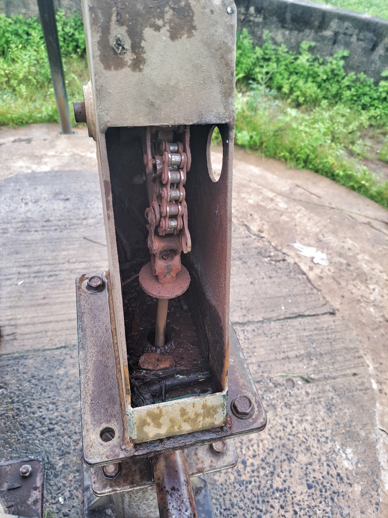
New cylinder, conversion head, concrete reinforcement, 2 culverts, hand washing station. The contractor will construct a new trough for the village ruminants to drink from, which will help the community economically.
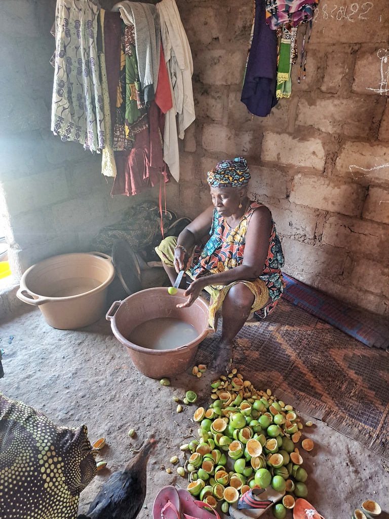
Jiramba is located about 3km north of the Trans-Gambia South Bank Road via Sangajor. It is a Jola community of about 250 people. It is a subsistence farming community growing groundnut, millet and rice. The women are involved in raising domestic animals such as goats and sheep. This helps to alleviate hunger during the hunger season from June to August. The community is remote and mostly forgotten. It has only one hand pump, which used to serve the entire community, but it broke down over time. The community has long used open wells for drinking and other household activities. It is also home to several refugees who fled from the Cassamance region of southern Senegal. The water crisis in this village is enormous.
KURUDULAI VILLAGE

GPS: N13°13.550 W016°05.108, Population: 300
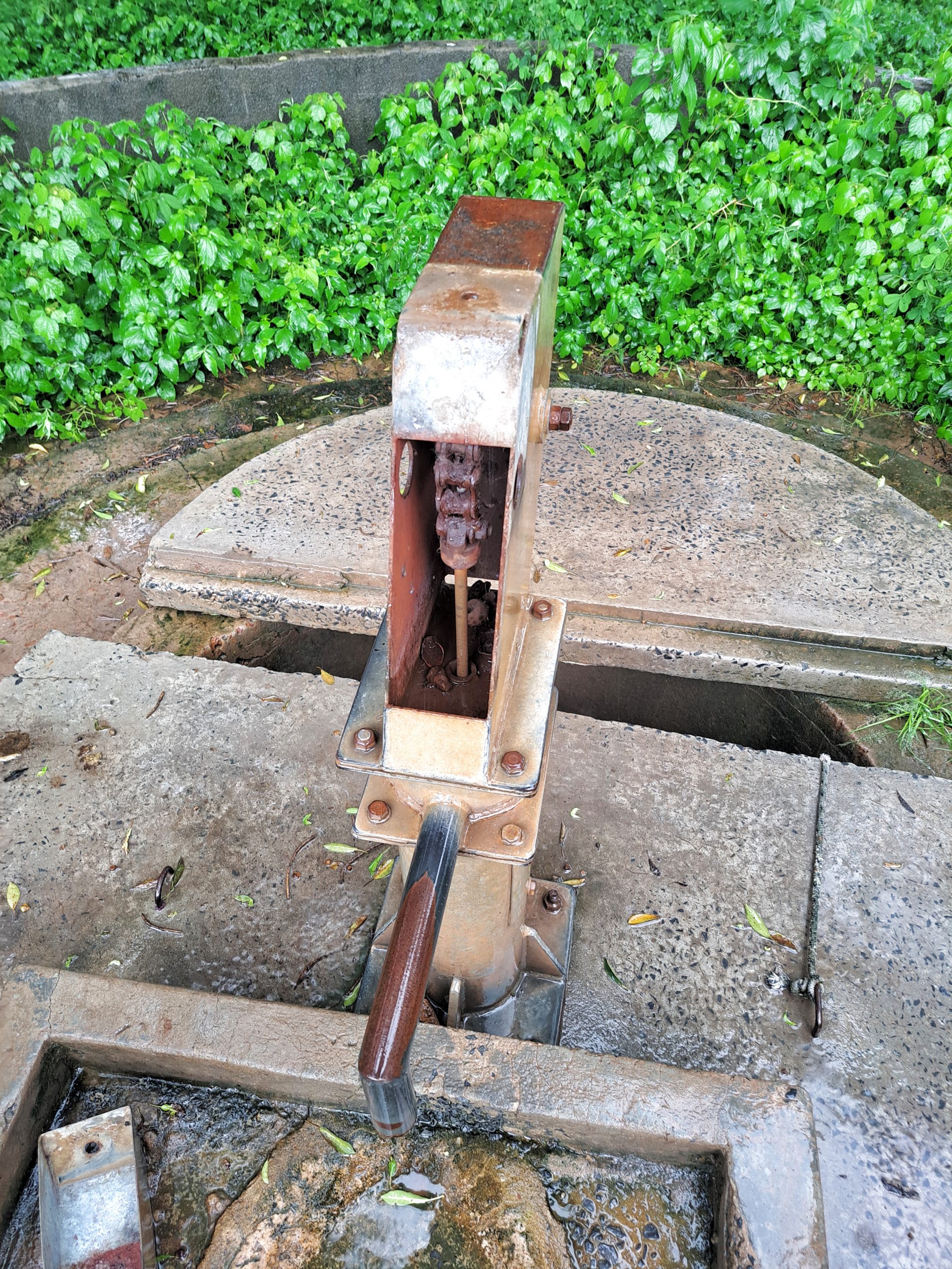
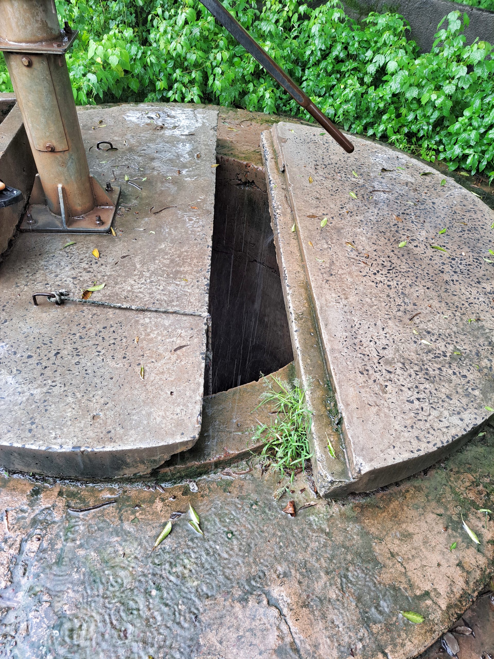
New cylinder, conversion head, 1 stainless steel pipe, concrete slab reinforcement, dewatering and sanitizing well. The contractor will construct a new trough for the village ruminants to drink from, which will help the community economically.
This community is located at the Bujiga Junction along the Trans Gambia South Bank Road. It is about one kilometer from Bwiam. The community is a subsistence farming community growing groundnut, millet and rice with some growing traditional Jola delicacy herbs called “Kuchaa”. The village has been suffering from water shortage as the only water source serving the community broke down years ago and as a result, some people have resorted to using open wells which has resulted in sickness, especially among women and children.
SARINGA VILLAGE

GPS: N13°13.201 W016°06.269, Population: 250
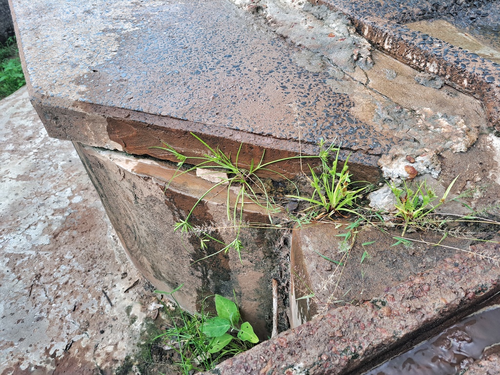
New cylinder, rod couplings (stainless steel), conversion head, concrete reinforcement, hand washing station. The contractor will construct a new trough for the village ruminants to drink from, which will help the community economically.
This community is located about 2 KM northeast of Kambong along the Trans-Gambia South Bank Road. It is a remote and isolated community. It is a subsistence farming community growing groundnut, maize and millet. The village women are engaged in the seasonal cultivation of indigenous forest fruits such as “kaba” and “foleh”. These are often sold at the weekly markets in Bwiam and Kalagi. The proceeds are used to support household food for survival. The community is a Jola tribe community with a handful of Fula tribe who migrated from the eastern part of the country. The community has only one water source, which has not been working for a long time, causing severe water shortages in the village and forcing villagers to travel to distant Kambong and other villages in search of water.

To read details about the Foni Kansala District Handpump Repair Tour Phase 1, CLICK HERE.
To read details about the Foni Kansala District Rehab Tour – Phase 2, CLICK HERE.