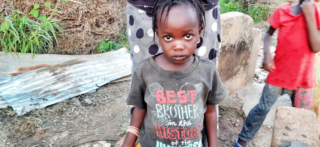
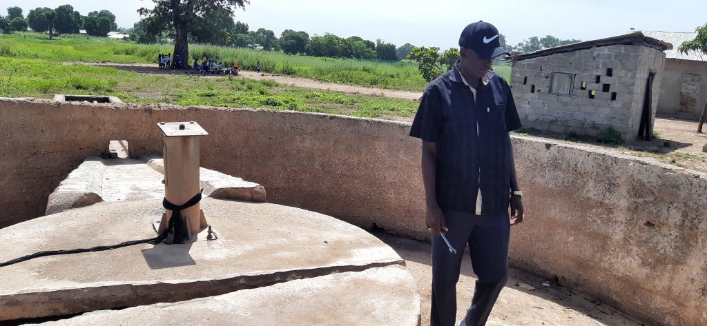
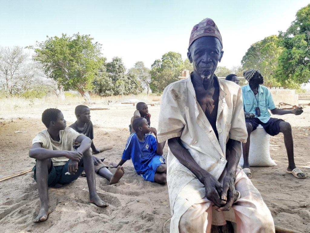
Foni Kansala- is one of the nine districts of the Gambia‘s West Coast Region, which is located to the south of the Gambia River in the southwest of the country. Foni Kansala is in the southeast of the division, between Foni Bintang-Karenai and Foni Bondali. This area of the country is prone to illegal deforestation especially in rosewood. The area is also prone to wildfires and as a result this has led to scarcity of fresh drinking water. According to Global Forest Watch reports, in 2010, Foni Kansala District has 29.9ha of tree cover, extending over 0.21% of its land area. In 2009, it lost 75.0mha of tree cover, equivalent to 23.0t of CO2 of emissions. In Foni Kansala District, the peak fire season typically begins in mid-February and lasts around 12 weeks. All these factors have made life harder for the indigenous tribes that live within the district especially when it comes to clean drinking water. Notably the district is dominated by the Jola tribe and a handful of Mandinka tribe.
Lulu Chorr Village
GPS: N13ᴼ10.412 W016ᴼ06.987
Population: 300
New cylinder, 6 stainless steel pipes, check nuts, bearings, concrete slab, hand washing station. The contractor will construct a new trough for the village ruminants to drink from, which will help the community economically
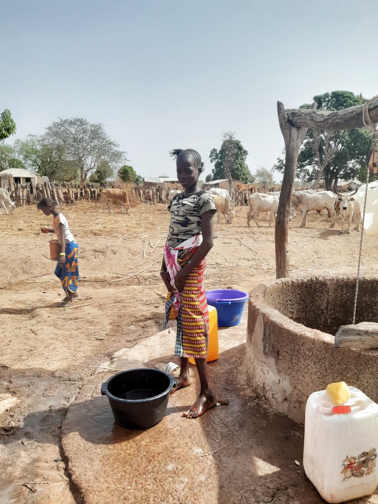
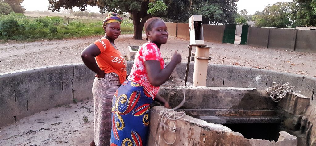
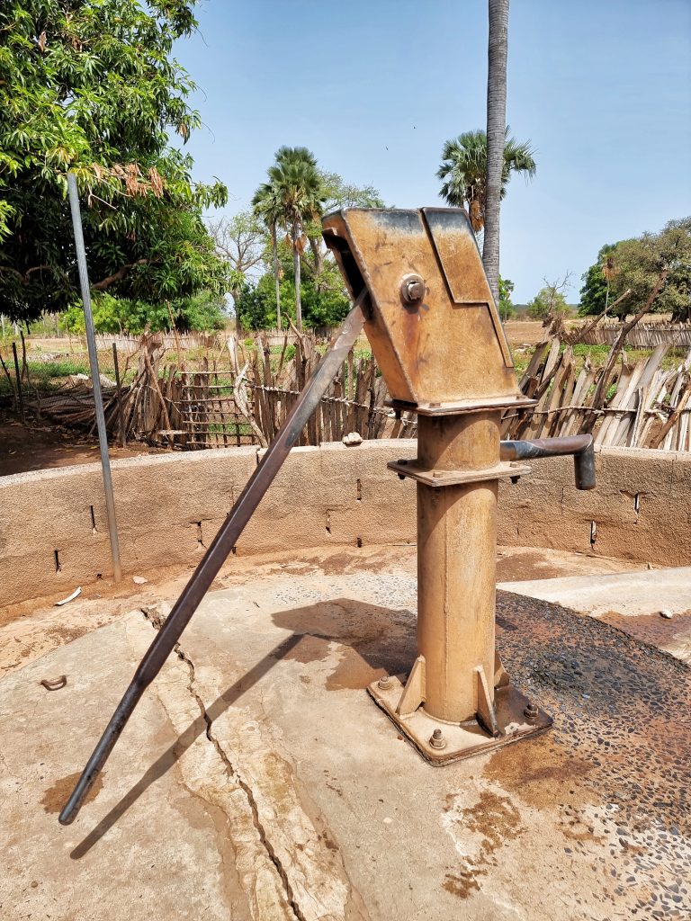
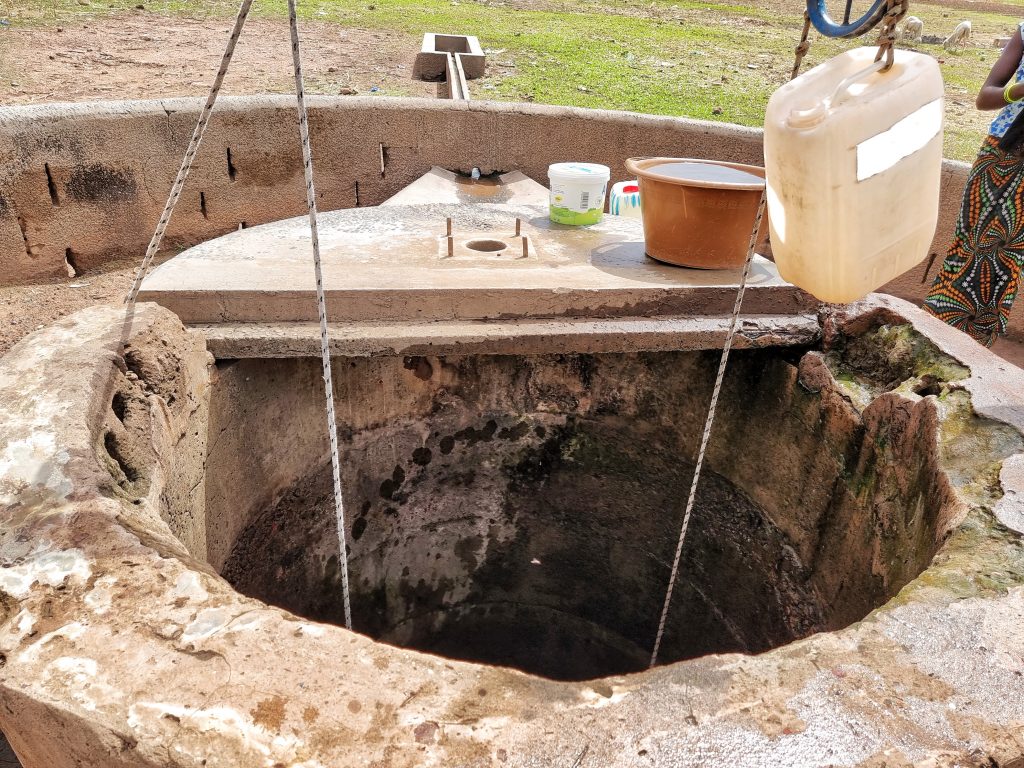
Tintiba Village is located about 6km north of the Trans-Gambia south bank road via Kamfenda main junction. It is a Mandinka tribe community of roughly 250 people. It is a fishing community that depends on the banks of the river Gambia. Tilapia, bonga fish oyster are the most common fish species caught. This community is remote and most often forgotten. It has only one handpump which the entire community depends on and it broke down overtime. For a long while now, the community is using open well for drinking and other household activities which has the potential for outbreak of waterborne diseases.
SANGAJOR VILLAGE
GPS: N13°13.902 W016°00.543
Population: 450
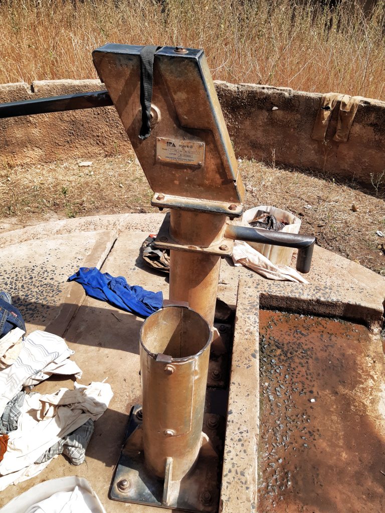
2 New cylinders (twin hand pump), rod couplings (stainless steel), 2 conversion head, plus hand washing station. The contractor will construct a new trough for the village ruminants to drink from, which will help the community economically
Sangajor Village is located along the Trans-Gambia south bank road. It is a Jola and Mandinka tribe community. It is a subsistence farming community which grows groundnut, maize and millet. The community is large and have any water source that barely works. This has resulted into severe water shortages for the community especially affecting women and children.
BARO KUNDA VILLAGE
GPS: N13°13.829 W016°03.934
Population: 180
7 stainless steel pipes with rods, new conversion head, new cylinder, pedestal, check-nuts, dewatering and sanitizing the well, hand washing station. The contractor will construct a new trough for the village ruminants to drink from, which will help the community economically
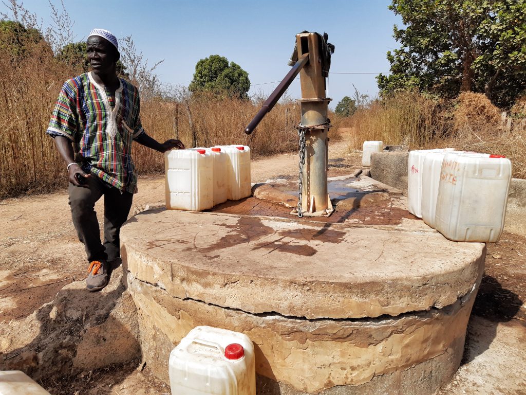
Baro Kunda village is a small Mandinka village localed along the Trans-Gambia highway south bank road. The inhabitants of the community are the Mandinka Tribe who migrated from Eastern Gambian region of Sandu about a century ago. The migration was as a result of clashes between rival villages and as a result the Barro Kunda elders decided to migrate towards this area in search of peace which led to the founding of this village called Barro Kunda. The community has only one water source which keeps breaking down and always leads to shortage of water for the community. As a result, women frequently walk miles to neighboring villages in search of water.
JOMO KUNDA VILLAGE
GPS: N13°15.890 W015°59.879
Population: 300
New cylinder, conversion head, bearings and axle, hand washing station, concrete reinforcement, rod couplings. The contractor will construct a new trough for the village ruminants to drink from, which will help the community economically
This village is located about 3 KM off the Trans-Gambia south Bank Road via Sangajor. It is a Jola tribe community. It is a fishing village. They depend on the banks of the river Gambia for fishing. Almost the entire village depends on artisanal fishing with only a handful engaged in subsistence farming mainly growing rice. The Village has been suffering from lack of water due to the large number of people within the community. The current water source is not enough to serve the entire village and as a result some people took to open wells for usage which has resulted in sickness especially among women and children. The community is also hosting a number of refugees fleeing the Casamance conflict. This has also worsened the lack of water in the community.
KANKUNTU VILLAGE
GPS: N13°14.335 W016°05.084
Population: 400
4 stainless steel pipes with rods, 1 new conversion head, pedestal, check-nuts, hand washing station. The contractor will construct a new trough for the village ruminants to drink from, which will help the community economically
It is located about 3 KM off the Trans-Gambia south Bank Road via Bwiam. It is a community of about 400 people. The community is primarily made up of the Jola tribe. The village is also home to a small group of Fula herdsmen. It has two water sources one of which barely works and as a result it causes severe water shortage for the community. The community’s population has also increased as they host dozens of refugees fleeing the Casamance conflict. This has severely worsened the water crisis.
DOBONG VILLAGE
GPS: N13°14.359 W016°04.383
Population: 300
2 new cylinder (twin hand pumps), 2 stainless steel pipes, hand washing station. The contractor will construct a new water trough for the village ruminants to drink from, which will help the community economically.
This community is about 1 and half km from Bwiam along the Trans-Gambia south bank road. It is a Manjago and Jola mixed tribe community. It is a subsistence farming community. The community is facing water shortage as its only water source with twin hand pumps has broken and as a result, they travel about 1 and half km to the neighboring village of Bwiam to fetch water on a daily basis. This has disrupted their life and sustenance.
KAMBONG VILLAGE
GPS: N13°12.888 W016°06.334
Population: 300
1 new cylinder, conversion head, bearings and axle, hand washing station, rod couplings. The contractor will construct a new trough for the village ruminants to drink from, which will help the community economically
Kambong Village is located along the Trans-Gambia south Bank Road. It is a Jola and Fula tribe community. Both tribes live peacefully together. It is a subsistence farming community, growing groundnut, millet and rice. The Village has been suffering from lack of water due to the large number of people within the community with only one water source has been broken for a long time. The community’s only one water source is been broken for a long while and as a result open wells are used for drinking. Some people walk miles to other neighboring villages for water. The influx of refugees fleeing the Casamance conflict has worsened the situation.
DUMBUTO VILLAGE
GPS: N13°15.360 W016°02.544
Population: 250
1 New cylinder, a new concrete slab, rod couplings (stainless steel), 7 stainless steel pipes, conversion head, dewatering and sanitizing the well, plus hand washing station. The contractor will construct a new trough for the village ruminants to drink from, which will help the community economically
This isolated and remote community is a subsistence farming community, growing groundnut and rice. It is a Jola tribe community. The community is facing water crisis as its water sources have all broken down. It is also hosting refugees fleeing Casamance conflict which has made the situation worse.
KAMFENDA VILLAGE
GPS: N13°13.724 W016°02.590
Population: 250
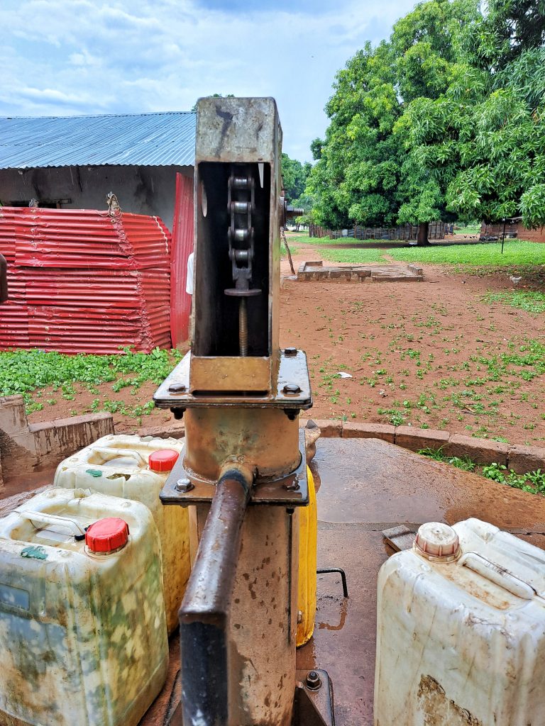
1 new cylinder, 4 stainless steel pipes, dewatering and sanitizing the well, check nuts, conversion head, hand washing station, new concrete slab. The contractor will construct a new water trough for the village ruminants to drink from, which will help the community economically.
Kamfenda Village is located along the Trans-Gambia South Bank Road. It is a farming community growing groundnut, millet and corn. It also has some traditional blacksmiths making traditional farming implements like hoes, axe etc. The community is a crucial point linking several villages within the south bank and southern Senegalese region of Casamance and as a result it has become a hub for several indigenous villagers in terms of inter commerce and exchanges. The community has about 1,500 people but the people living on the north east part of the village are isolated and as a result the water source within that area has not been working causing severe water shortage for the community. Tension have been rising within the community as a result of the water crisis. The area has a population of about 250 people.
BUNYAI VILLAGE
GPS: N13°13.352 W016°00.764
Population: 200
New cylinder, conversion head, 9 stainless steel pipes, pedestal, tank, concrete slab, concrete reinforcement, 4 culverts hand washing station. The contractor will construct a new trough for the village ruminants to drink from, which will help the community economically Bunyai is located about 1km south of the Trans-Gambia south bank road via Sangajor. It is a Jola community of roughly 200 people. It is a subsistence farming community growing groundnut, millet and rice. This community has only one handpump which used to serve the entire community and it broke down completely thereby causing the community waterless. This emergency situation has prompted the community to drink from unclean and contaminated water sources for a long while now, the community is using open wells for drinking and other household activities.

This project has been completed. To read about the conclusion of the project, CLICK HERE.
To read details about the Foni Kansala District Rehab Tour – Phase 1, CLICK HERE.
To read details about the Foni Kansala District Rehab Tour – Phase 3, CLICK HERE.