
Niamina East is one of the ten districts of the Central River Region of The Gambia. It is located within the Janjanbureh Area Council. The district covers an area of about 395.6 km² with a population of about 34,000, of which 47.5% are male and 52.5% are female. Subsistence farming remains the dominant occupation in the district. The district is well known for its “Kangkurang” festivals and the ancient cultural practice of “Namasita”. It is also a historical and cultural place bearing the marks of the Kurang, Marena and Ceesay clans.
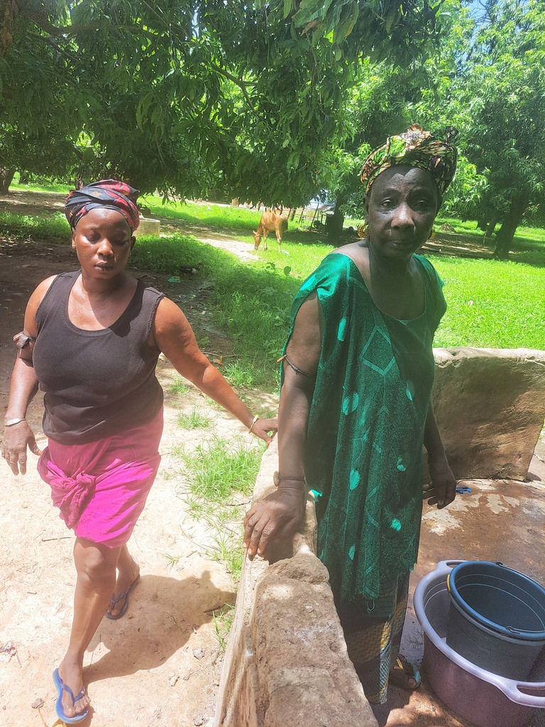
The Central River Region is one of the poorest regions in The Gambia, and within the region, Niamina East District remains poor, especially in the area of water sanitation and hygiene, with a lack of basic clean water and sanitation. According to the Multiple Indicator Cluster Survey (MICS). 1% of the country practices open defecation. The Central River region accounts for a large proportion of this population. This is a result of the unavailability of basic clean water, sanitation and hygiene in communities across the region.
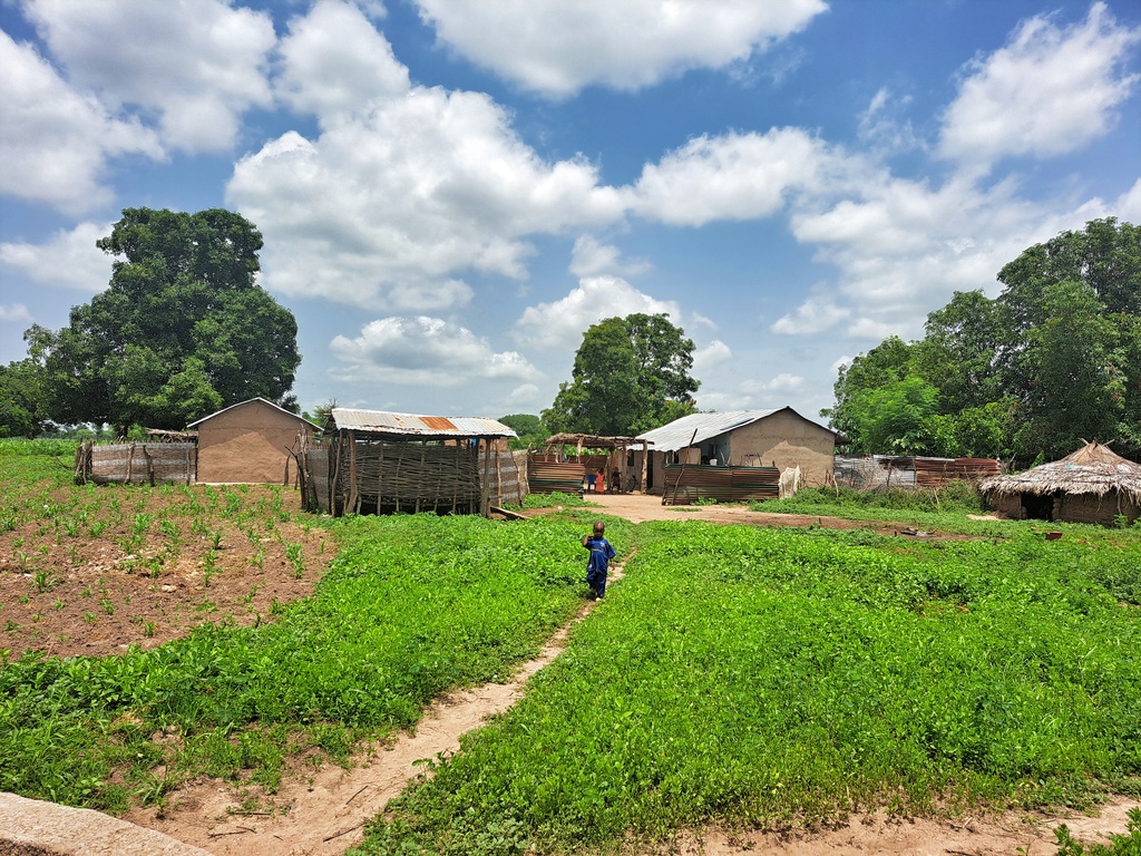
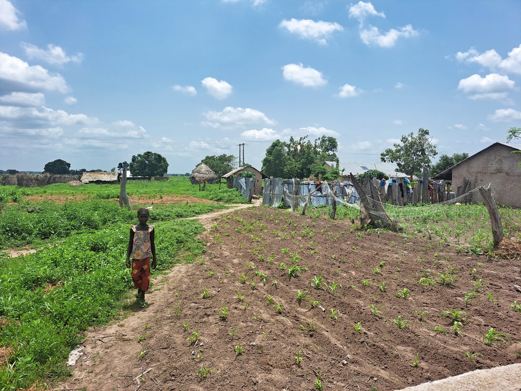
Kudang, one of the market towns in the district. A weekly market is held in the town, locally called “Loumo”. Communities across the district practice the weekly “Loumo” market, where farmers and local traders gather in the town of Kudang to sell their goods. This attracts people from across the border villages in Senegal. Most people in the villages of Niamina East are engaged in subsistence agriculture – there is a recognized “hungry season” when food is scarce but agricultural work is most intense. There are serious environmental and ecological vulnerabilities, especially with increasing desertification. The district is also home to mangroves, which are found at the land-sea interface in tropical regions and provide a considerable range of ecosystem goods and services. Mangrove ecosystems are highly effective carbon sinks, sequestering large amounts of carbon in the soil, leaves, branches, roots, etc.
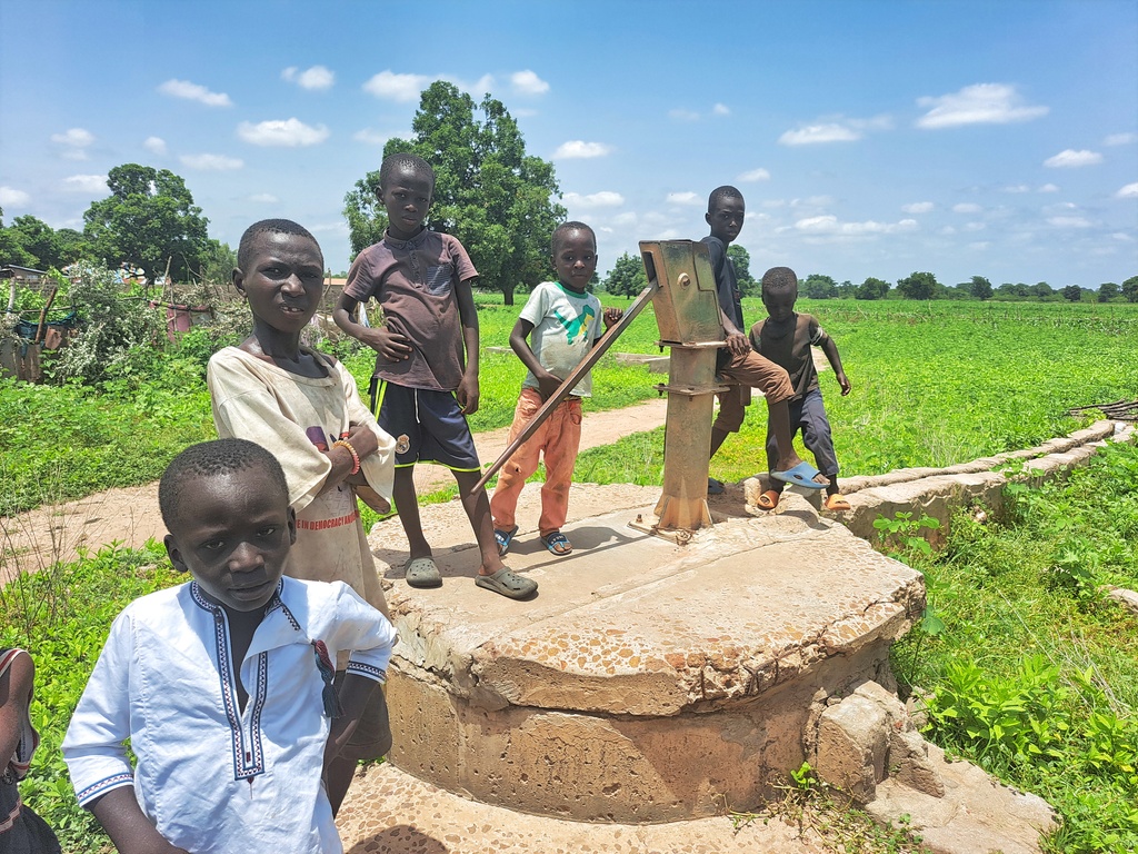
Water Charity’s Water for Everyone – The Gambia program aims to give five communities in the Niamina East District access to clean drinking water and improve sanitation for over 3,500 individuals, especially vulnerable women and children. We are committed to helping the people of Upper Saloum overcome the challenges they face and improve their quality of life.
BAMBAKOLONG VILLAGE

GPS: N13°36.453 W015°08.150, Population: 300

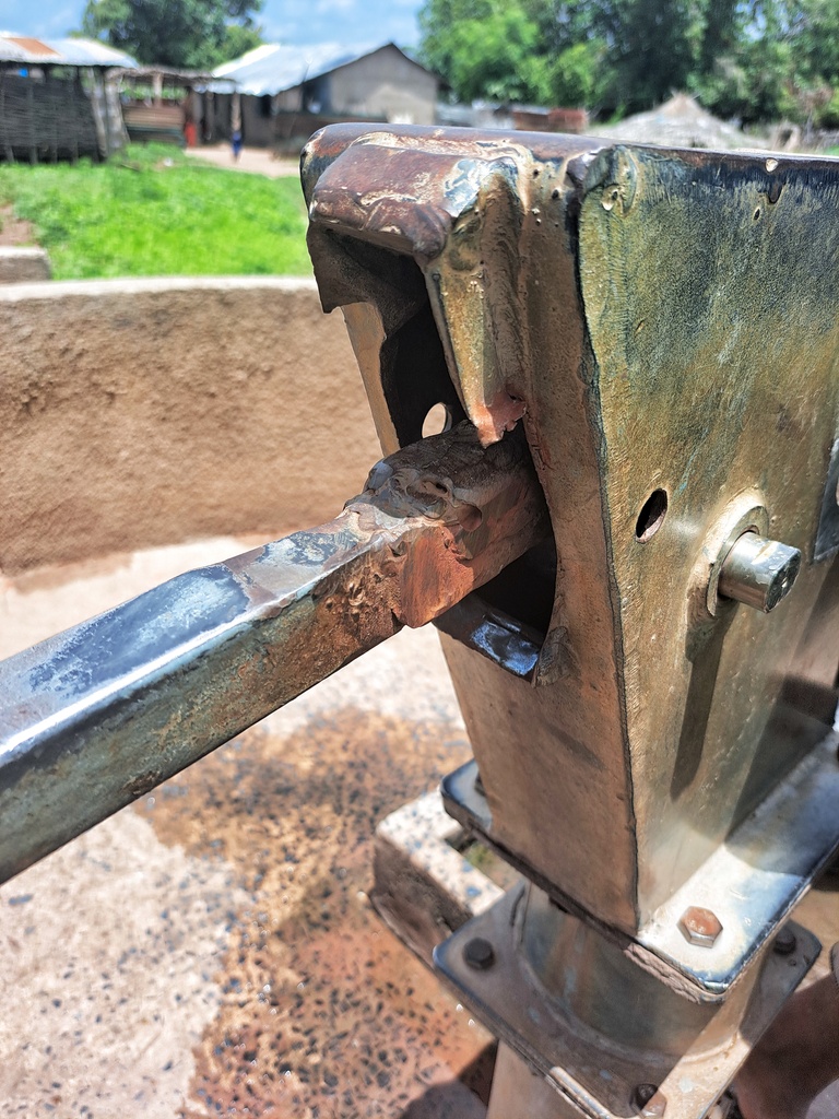
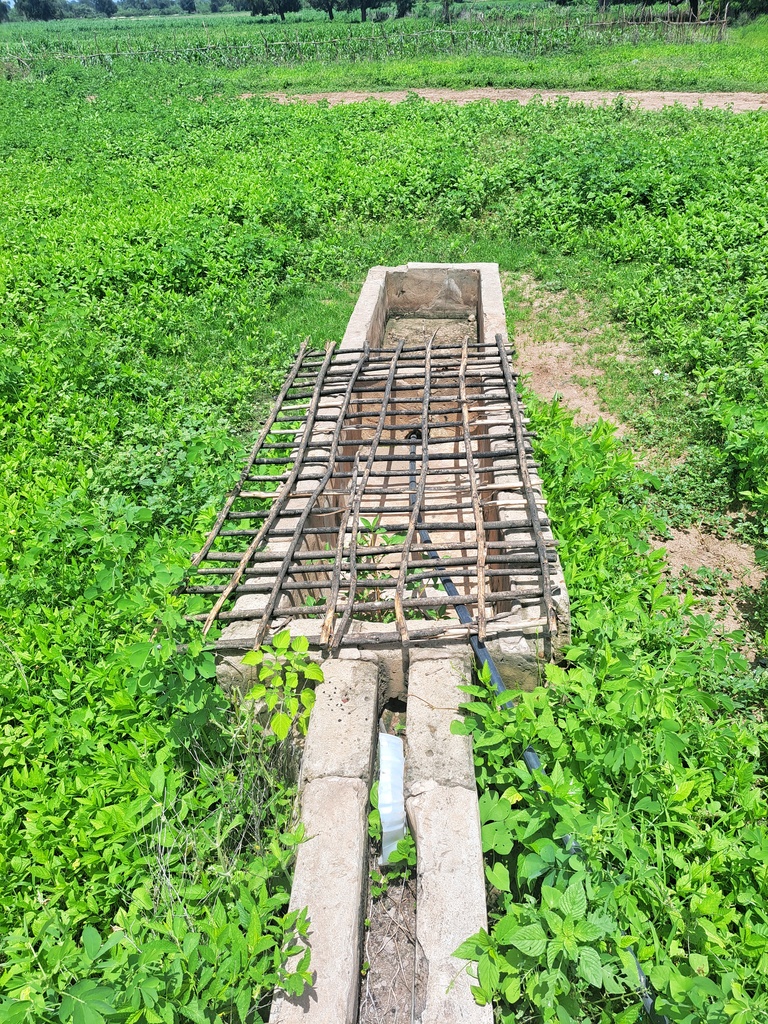
1 Conversion head, 1 new cylinder, 2 stainless steel pipes, concrete slab, de-watering and sanitizing well, hand washing station, new concrete slab. The contractor will construct a new water trough for the village ruminants to drink from, which will help the community economically.
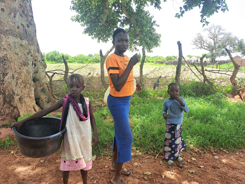
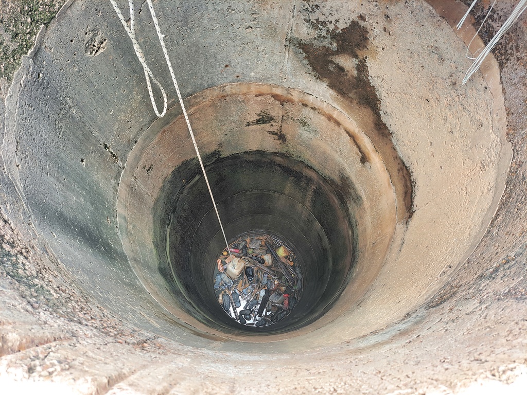
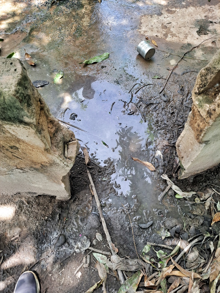
Bambakolong is a village located on the Trans-Gambia South Bank Road about 12 km west of Kudang. The community is a Fula and Mandinka settlement. The village name is derived from the Mandinka words Bamba Kolongo which means crocodile pool. It is believed to be an ancient traditional shrine for early animist settlers. The community is a subsistence farming community that grows maize, peanuts and rice. The community is facing a water crisis as the current water source is broken. This has resulted in many people using contaminated open wells, which has a detrimental effect on health.
MADINA CHAMEN VILLAGE

GPS: N13°37.177 W015°07.438, Population: 250
New cylinder, conversion head, dewatering and sanitizing well, 1 stainless steel pipe, rod couplings, 7 centralizers, hand washing station, the contractor will construct a new trough for the village ruminants to drink from, which will help the community economically.
This village is located about 9 km west of Kudang along the Trans-Gambia South Bank Road. It is a community of the Wollof Fana Fana tribe. The ancestral lineage of the village is the Cham dynasty who are believed to have migrated from the ancient Senegalese kingdom of Walo and Kajor and later settled in various parts of the Gambia in the early 19th century. The Cham clan are believed to be well-known blacksmiths, locally called “Tegga”, and some still maintain these cultures. However, they are sometimes stigmatized and treated as inferior to the “Guewel” (praise singers) within the Wollof social fabric. The community is a subsistence farming community, growing groundnuts, millet and rice, with a handful practicing traditional blacksmithing, making hoes, axes and other traditional farming implements. The village has been suffering from lack of clean drinking water as the only water source in the village has broken down and as a result they have been using old open wells which has caused serious health complications.
SINCHU GUNDO VILLAGE
GPS: N13°36.902 W015°01.880, Population: 800
1 conversion, dewatering and sanitizing the well, 1 stainless steel pipe, hand washing station. The contractor will construct a new trough for the village ruminants to drink from, which will help the community economically.
This community is located about 9 km east of Kudang along the Trans-Gambia South Bank Road. It is a Fula community with some new settlers from the Bambara tribe who migrated from Mali as a result of the crisis in Mali. The community is thriving and living in harmony. The Fula tribe of the village are traditional herders of the “Torrodo” of Fouta Torro, but the village itself is a subsistence farming community that grows maize, peanuts and corn. The community is facing a water crisis as the water source that serves the community has been broken for a long time and as a result they travel to the neighboring village of Sinchu Alagie to get a few buckets of water. This is not often well received by the community of Sinchu Alagie, with whom they have had some land disputes in the past. Providing them with a working clean water source will go a long way in preventing any future disputes or fights between them and their neighboring villages.
TUBA DEMBA SAMA VILLAGE
GPS: N13°39.871 W014°58.528, Population: 900


New cylinder, 1 conversion head, rod couplings (stainless steel), 6 stainless steel pipes, dewatering and sanitizing the well, concrete slab enforcement, plus hand washing station. The contractor will construct a new trough for the village ruminants to drink from, which will help the community economically.
This village is located about 5km northeast of Kudang Junction on the Trans-Gambia South Bank Road. The community is a Mandinka tribal settlement. The community depends on subsistence farming, mainly groundnut, millet and maize. Some people also fish tilapia, crabs and oysters from the mangroves along the banks of the Gambia River. Women also collect traditional medicinal herbs from the bush and usually sell them at weekly markets called “Loumo” in Kudang. This helps to support the household and other social activities. The community is facing a severe water crisis as the current water source is not sufficient for the community, resulting in many households relying on contaminated open wells with serious health implications.
SOTOKOI VILLAGE
GPS: N13°38.736 W015°06.473, Population: 1200

1 Conversion head, 1 new cylinder, check-nuts, rod couplings, 6 centralizers, concrete slab enforcement, 50cm perimeter fencing (for animal intrusion), hand washing station, the contractor will construct a new water trough for the village ruminants to drink from, which will help the community economically.
Sotokoi Village is located on the Trans-Gambia South Bank Road about 7km west of Kudang. It is a Mandinka community. The community is a subsistence farming community that grows groundnuts, millet and maize. The community suffers from water scarcity due to its size and a very limited water source. Those on the outskirts of the village are often without water, making them more vulnerable to open wells and other contaminated waterborne diseases. Although a decade long, the land dispute between Sotokoi and Njie Kunda village has been resolved. The effects of the water shortage still linger in the community, as they are reluctant to travel to neighboring Njie Kunda village in search of water.