Water Charity is excited to announce its latest project in Analalava, Madagascar, as a significant part of our Water For Everyone(WFE) – Madagascar program.
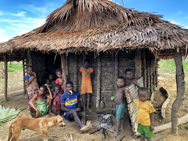
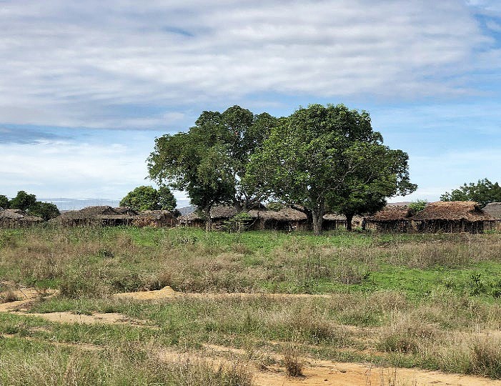
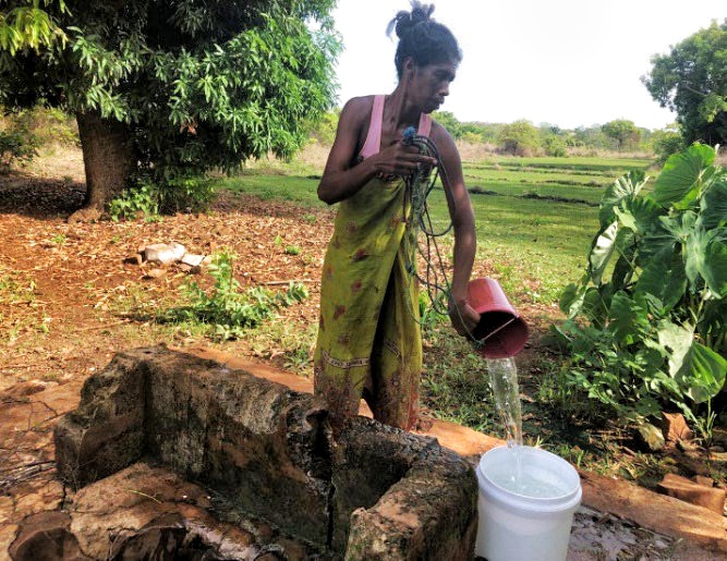
The coastal District of Analalava, nestled within the Sophia Region of Northwest Madagascar, boasts a predominantly rural landscape, characterized by limited accessibility, especially during the rainy season. The villages within the district, ranging in population from 400 to over 1000 inhabitants, rely primarily on fishing, farming, and livestock for their livelihoods, with malnutrition being relatively uncommon. However, apart from the Village of Analalava, where a municipal water system has twice failed, there is a glaring absence of water infrastructure across the area. Local attempts to access clean water have been futile, with many resorting to using seawater and undertaking lengthy journeys inland in search of freshwater sources. Consequently, waterborne diseases are widespread, underscoring the urgent need for long-overdue assistance in this deserving community.
During an 8-day field assessment in November 2023, our team evaluated 10 villages. After consulting with local officials, it was determined that the assessments and recommendations were applicable to all villages in the area.
Mission objectives
- Identify and assess the capabilities of existing water infrastructure;
- Quantify population data and assess their vulnerabilities and needs for fresh water;
- Determine the work required to close the gap between current capabilities and the needs of the local population;
- Develop a coordinated work plan to provide fresh water to villages where needed;
- Design a logistics plan that can function during the rainy season.
Program Summary
The primary objective of the early 2024 program is to provide fresh water to as many villages as possible, which is estimated to be around 30 villages. The program will involve restarting the municipal water system in the Village of Analalava. Water Charity and the MWP will collaborate with local officials to establish a sustainable management system. The program encompasses three communes, namely Analalava, Ambolobozo, and Befotaka-Nord, and each of them represents an individual project. The first phase of this program targets the villages accessible by a combination of boats, ox carts, and 4 WD trucks, as shown in Figure 1 below.
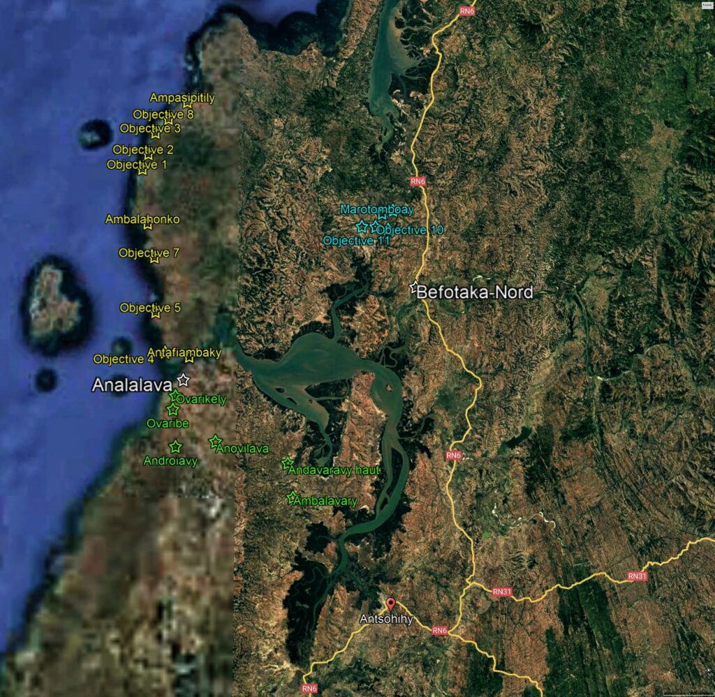
The program will mainly focus on the coastal villages located in the Ambolobozo Commune that are highlighted in yellow. These villages can be accessed by a combination of boats and ox carts. In addition, a limited number of villages that are accessible by 4WD trucks will also be targeted in the Communes of Analalava and Befotaka-Nord. Antsohihy, which has water access to the coast, will serve as the base of operations.
Demographic Data:
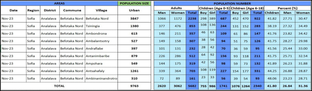
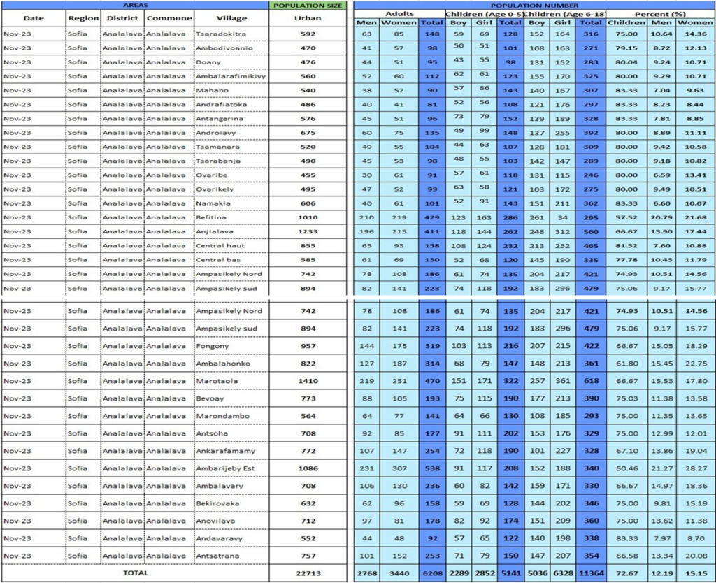
Detailed population and health data were obtained for the Communes of Analalava and Befotaka-Nord.
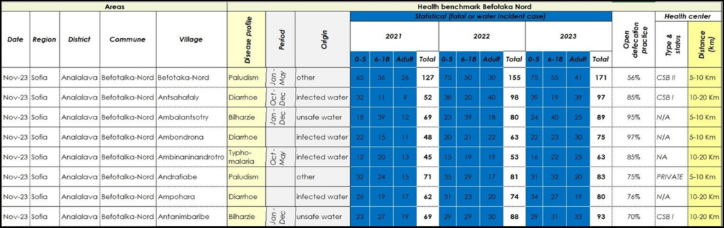
Befotaka-Nord
Ambolobozo
The Commune of Ambolobozo has not yet provided demographic data. However, our team has conducted an extensive evaluation of the area. Based on this assessment, it is reasonable to assume that the population in Ambolobozo is similar to the populations in the surrounding communes of Analalava and Befotaka-Nord. Using Google Earth, the assessment team has identified ten villages in the area with an estimated population of 7,000.
Analalava
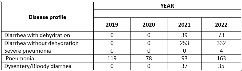
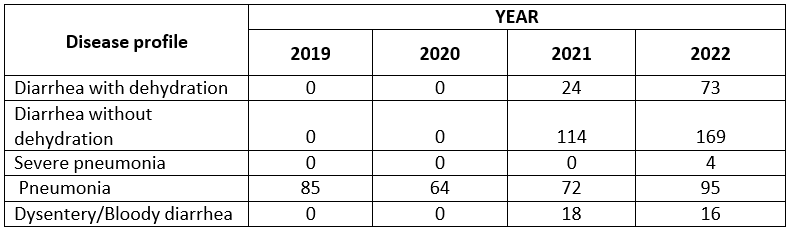
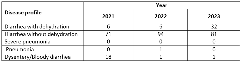
The Analalava Project’s first phase will involve drilling 20 new water wells for an estimated 13,300 people, taking into account demographic data and logistical limitations during the rainy season. Additionally, restarting the Analalava municipal water system will benefit 3,000 more people. This project will take around two months and will cost an estimated USD 40k, which averages to approximately $2.45 per beneficiary. This area lacks a reliable freshwater source, and other NGOs are unlikely to provide aid. The health data provided by the Communes indicate a rise in waterborne diseases in recent years.
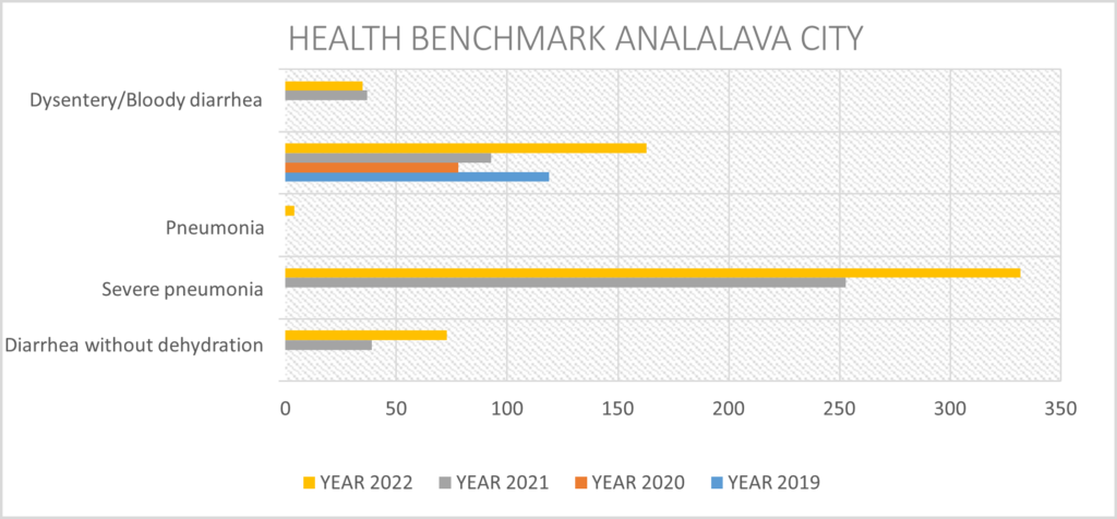
Health Data: clearly the health data trends show a need for immediate attention.
Befotaka-Nord
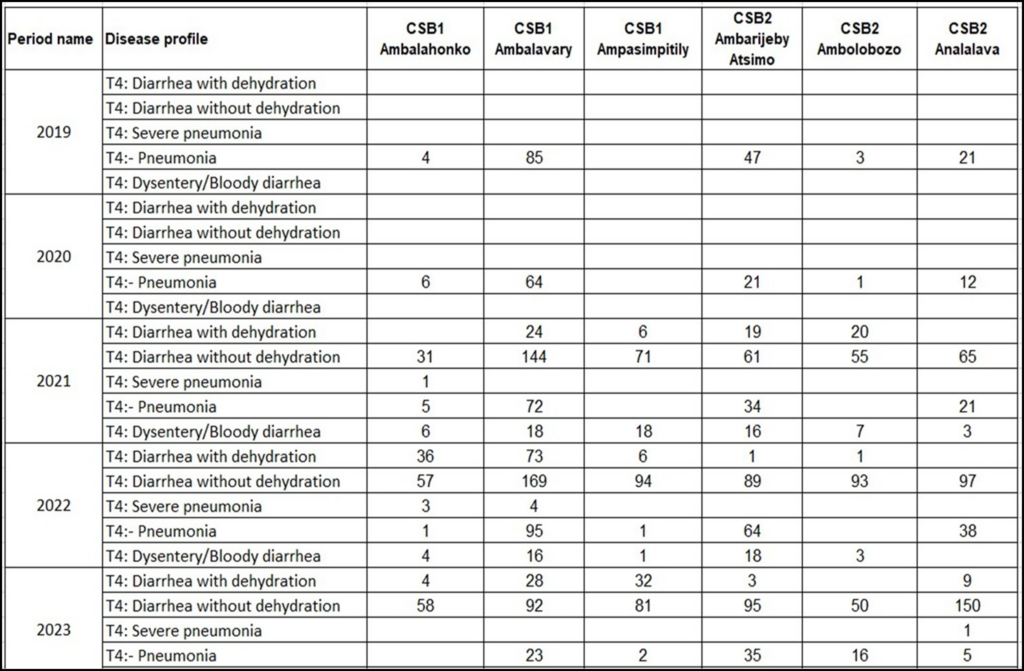
Clinic Data: All Communes
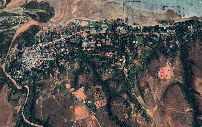
ANALALAVA COMMUNE Lat 14°38’5.67″S Long 47°44’51.06″E
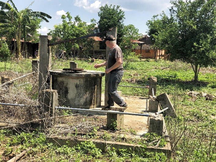
The Village of Analalava, which includes four fokontany, has a large water distribution infrastructure built by the Madagascar Government in 2014; however, it failed due to mismanagement. The existing water system consists of:
- a catchment structure collecting water from an underground spring with a pump to the holding tank;
- a three-room operating building with a 17.5 KVA generator;
- a 110 m3 circular holding tank;
- a chlorination unit;
- a 7.4 km water distribution system of PEHD pipes of various sizes;
- eighteen (18) standpipes with two taps.
Management of the system
The local water system was initially managed by the commune and functioned smoothly for a couple of months. However, it eventually went out of service due to a lack of fuel for the generator that powered the water pump. The water system was then taken over by a private company under an agreement with the municipality. Unfortunately, the company faced business problems which led to the discontinuation of its activities on the ground. Since then, the water infrastructure has remained inoperative and gradually deteriorated. As a result, the local people have had to revert to using their traditional water sources.
Current status of the system
| Device | Capacity | Unit | Current status |
| Catchment tank | 1 | In good shape might need small rehabilitation | |
| Retention tank | 1 | In good shape, might need slight works | |
| Holding tank | 1 | In good shape might need slight repair | |
| Water treatment tank | 1 | In good shape ,might need slight touch-up | |
| Submersible pump | Q= 12m3/h,triphase 380V P=6,5 KW with low water control | 1 | Unoperational need to be replaced |
| Genset | 17 KVA | 1 | Looks good but need to be checked |
| Standpipe | Two taps standpipe | 18 | In good shape, may need small finishing and repairs |
| Pipe line | 1 | Still connected with few leaks to be fixed |
Health Data
Developing a sustainable management system is crucial to minimize daily expenses like fuel and ensure reliable service during the restart of the water system.
OVARIKELY VILLAGE Lat 14°39’2.50″S Long 47°44’32.50″E
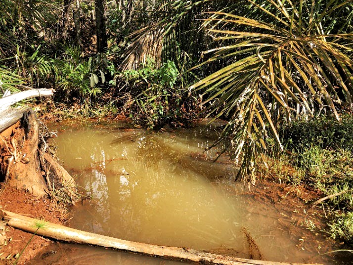
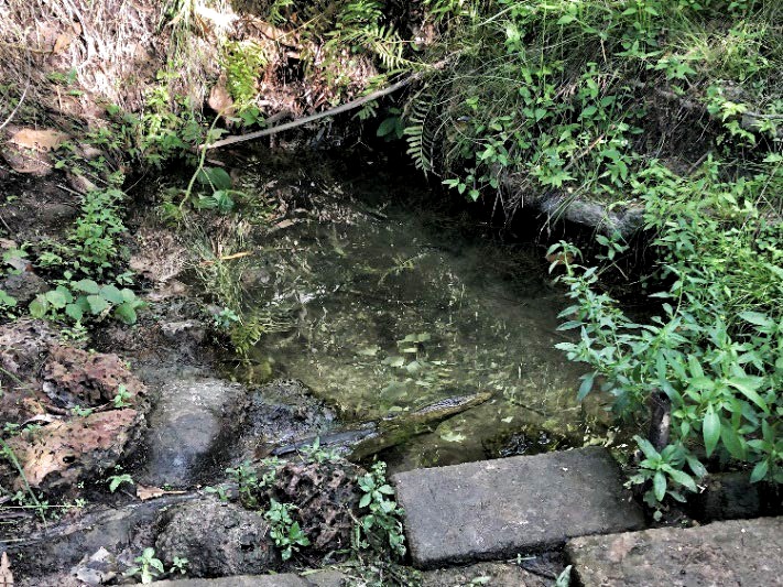
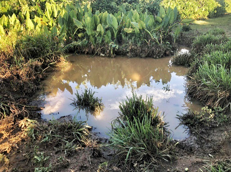
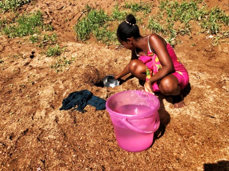
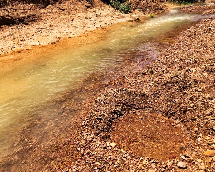
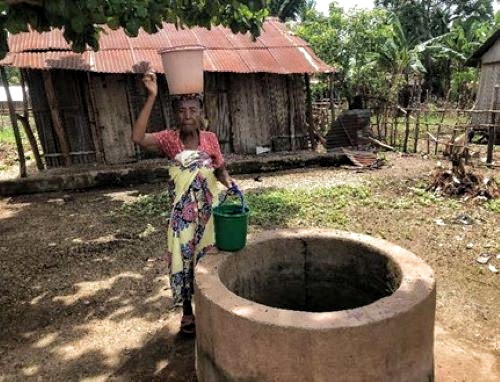
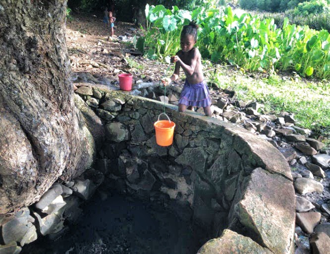
Ovarikely Village is a small hamlet with a population of 495 inhabitants, located 3.7 km north of Analalava and belonging to the Commune of Analalava. The majority of the villagers work as farmers and breeders, raising cattle, poultry, and other animals. Unfortunately, the village lacks a proper water infrastructure, and people have to spend around 45 minutes to fetch water from a nearby river, which becomes dirty and muddy during the rainy season. The village can be reached by road via the National Road 31A and Analalava.
Current water sources for Ovarikely Village
Recommendation
To drill one (1) well equipped with hand pump.
OVARIBE VILLAGE Lat 14°39’57.10″S Long 47°44’22.50″E
Ovaribe is a village located in the Analalava commune, which is comprised of fifteen fokontany villages. The village has a population of 455 people, who are primarily farmers and tend to build their houses in close proximity to their crops. Unfortunately, the village does not have any drinking water infrastructure, and therefore relies on a river and a traditional water source to fulfill their water requirements.
Current water sources for Ovaribe Village
Recommendation
Drill one or two wells with hand pumps.
ANDROIAVY VILLAGE Lat 14°42’28.40″S Long 47°44’35.20″E
Androiavy is a small village located 9 kilometers north of Analalava. It has a population of 675 people and can be reached by car in 40 minutes. It is best to operate in the village during the dry season as some parts of the road are narrow and can be slippery during the rainy season. The villagers are willing to contribute to the widening of the access road once the operation has started.
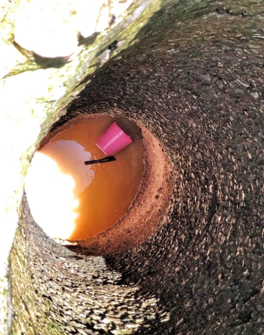
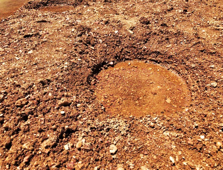
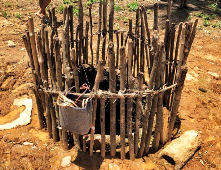
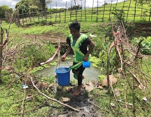
Currently, there is no existing infrastructure in the village. The locals get their water from a traditional source that is frightening and extremely dangerous. Large crocodiles live inside the source and are known to attack people. Unfortunately, a recent victim of crocodile bites was a child who passed away and a man who suffered severe injuries to his right leg.
Current water sources for Androiavy Village
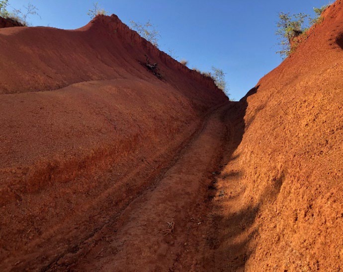
Narrow road to village
Recommendation
Drill one (1) well equipped with a hand pump.
ANDAVARAVY HAUT VILLAGE Lat 14°43’12.00″S Long 47°52’42.00″E
This village is located in the northeastern part of the commune and is a part of the municipality of Analalava. Although it appears small, it has a dense population with large households and is estimated to have a population of 250. The village can be reached by boat from Analalava in two hours, but accessing it depends on the tides.
Unfortunately, Andavaravy haut doesn’t have any water infrastructure, and the residents still rely on a traditional water source which is not always safe to drink. Additionally, there is no medical center nearby, so the villagers must travel to Analalava for any medical emergencies.
The geological structure of the village seems to make drilling operations a bit difficult, but it is a good candidate for the AK 60 drill.
Current water sources for Andavaravy Haut Village
Recommendation
To drill one (1) well equipped with hand pump.
ANDAVARAVY BAS VILLAGE Lat 14°43’30.00″S Long 47°52’27.00″E
Andavaravy is an essential part of the Analalava commune, with a population of around 300 friendly and enthusiastic people who are always ready to welcome and support any development project introduced in their village. To reach the village, one can take a boat from Analalava to Andavaravy Haut and then travel on foot or by zebu cart. The best time to visit the village is during the dry season, which is between May and October.
As for public infrastructure within the village, there is only a self-built school made of local materials. There is no public healthcare facility, but a paramedic takes care of the inhabitants. In case of serious medical emergencies, villagers have to be transferred to Antsohihy, which is a long and difficult journey to get better treatment. Moreover, there are no reliable sources of water in the vicinity, so people rely on a river or potholes on the eastern side of the village.
Current water sources for Andavaravy Bas Village
Recommendation
To drill one (1) well equipped with hand pump.
ANOVILAVA VILLAGE Lat 14°45’6.00″S Long 47°52’28.00″E
Anovilava is a small village situated northeast of Analalava, with a population of 712 people. The village can be accessed on foot and by zebu cart, and by road during the dry season, subject to repairs. The residents are willing to repair the road if a water supply project is initiated to provide them access to water.
Similar to other villages, Anovilava lacks water infrastructure and has no reliable source of water. The villagers have to depend on the downstream water source and use potholes when the river runs dry. Unfortunately, there is no public health service available in the village, and people have to travel to Antsohihy for severe cases. The geological structure of the village does not allow the use of manually operated drilling tools. However, the AK60 equipment is appropriate to drill a well in Anovilava, as it is located in a higher elevation.
Current water source for Anovilava Village
Recommendation
To drill one (1) well equipped with submersible pump, water tank, and distribute water through stand posts.
AMBALAVARY VILLAGE Lat 14°45’49.10″S Long 47°52’50.00″E
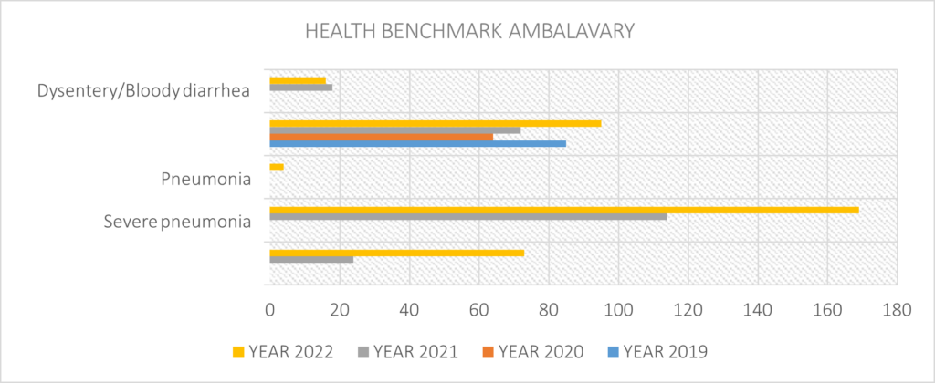
Ambalavary is a village located in the Commune of Analalava. It has a population of 708 people and is primarily inhabited by farmers and herders. The village is well-organized and clean. To reach Ambalavary, one can take a riverboat up to Andavaravy haut and then travel by cart through Anovilava. Locals mention that there is a road available for vehicles, but it is only passable during the dry season. Although the road is in poor condition, the villagers are willing to repair it if a project is initiated.
The village only has one well that produces sludgy water with low flow rates. Consequently, some people collect water from another traditional source located at some distance from the village. A basic health center is available, staffed by a single midwife. Ambalavary is set on higher ground, and the geological structure appears to be complex, with altered pebbles and other hard formations that are difficult to navigate.
Health Data
Current water sources for Ambalavary Village
Recommendation
Drill one (1) well equipped with submersible pump, water tank and stand posts.
AMPASIPITILY Lat 14°19’3.60″S Long 47°45’7.70″E
Ampasipitily is a large coastal village located in the Commune of Ambolobozo, within the Analalava district. The village is home to approximately 1,086 residents spread across 206 households, who make their living primarily through fishing and farming.
While the village has a few wells, only one bucket well is currently in use due to the others producing salty, brackish water or having run dry. To meet their water needs, the villagers typically fetch stagnant water. The aquifers in the area contain both fresh and saltwater, likely due to the village’s proximity to the ocean. Ampasipitily is accessible by boat from Antsohihy or Analalava, ox carts, and by road through Ambolobozo during the dry season.
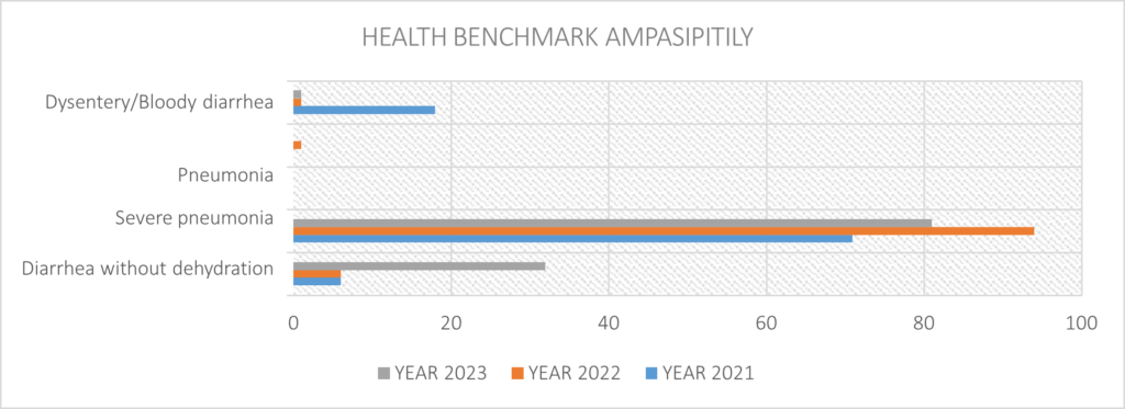
Health Data
Current water sources for Ampasipitily Village
Recommendation
Use of AK 60 drilling rig to drill one (1) well equipped with Submersible pump, holding tank, water distribution infrastructure.
AMBALAHONKO VILLAGE Lat 14°27’22.30″S Long 47°42’22.00″E
Ambalahonko is a small coastal village with a population of 500 people living in 145 households. The village is not easily accessible by road from Ambolobozo, but it can be reached by boat from Antsohihy or Analalava.
There are two wells in the village. One well equipped with a hand pump is located at the northern end of the village, but it is no longer functional. The other well is located in the FJKM religious school at the eastern end of the village. Although this well still supplies fresh water, it has a very low recharge rate. The villagers still use the traditional well in the northern corner of the village. Like many other villages, Ambalahonko faces water scarcity during the dry season.
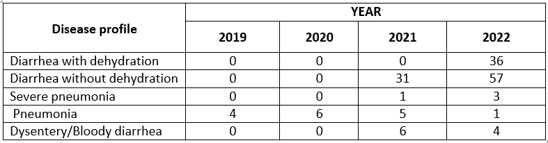
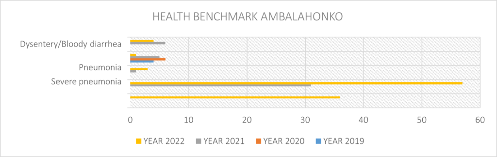
Health Data
Current water sources for Ambalahonko Village
Recommendation
Use AK60 drilling rig to drill two (2) wells equipped with hand pump.
AMPIHOARA VILLAGE Lat 14°26’15.90″S Long 47°59’37.70″E
Ampihoara is a village located in the Commune of Befotaka-Nord, situated on the road to Ambolobozo. The village has a population of 549 people. At the entrance of the village, there is a single well that is 12 meters deep. Local residents claim that it is abandoned because it supplies brackish water. As a result, villagers have to fetch water from a distant source in the river.
Current water sources for Ampihoara Village
Recommendation
To drill one (1) well equipped with hand pump.
| Location Id | Fokontany | Commune | District | Lat/Long |
| Ambalahonko | Ambalahonko | Ambolobozo | Analalava | S14 27 22.3 E47 42 22.0 |
| Ambalavary | Ambalavary | Ambolobozo | Analalava | S14 45 49.1 E47 52 50.0 |
| Ampasipitily | Ampasipitily | Ambolobozo | Analalava | S14 19 03.6 E47 45 07.7 |
| Ampihoara | Ampihoara | Befotaka-Nord | Analalava | S14 26 15.9 E47 59 37.7 |
| Ovaribe | Ovaribe | Analalava | Analalava | S14 39 57.1 E47 44 22.5 |
| Ovarikely | Ovarikely | Analalava | Analalava | S14 39 02.5 E47 44 32.5 |
| Androiavy | Androiavy | Analalava | Analalava | S14 42 28.4 E47 44 35.2 |
| Andavaravy bas | Andavaravy ambany | Analalava | Analalava | S14 42 37.9 E48 52 37.2 |
| Andavaravy haut | Andavaravy ambony | Analalava | Analalava | S14 43 30.2 E47 52 26.6 |
| Anovilava | Anovilava | Analalava | Analalava | S14 42 06.3 E47 47 22.3 |
| Antafiambaky | Antafiambaky | Analalava | Analalava | S14 36 22.1 E47 45 28.2 |
| Marotomboay | Ampihoara | Befotaka-Nord | Analalava | S14 26 28.6 E47 58 52.2 |
| Catchment area | Analalava | Analalava | Analalava | S14 38 08.8 E47 45 48.5 |
| Reservoir | Analalava | Analalava | Analalava | S14 38 00.3 E47 45 48.5 |
| BF 01 | Analalava | Analalava | Analalava | S14 37 14.0 E47 45 13.0 |
| BF 02 | Analalava | Analalava | Analalava | S14 37 21.2 E47 45 10.7 |
| BF 03 | Analalava | Analalava | Analalava | S14 37 33.6 E47 45 04.7 |
| BF 04 | Analalava | Analalava | Analalava | S14 37 41.6 E47 45 01.2 |
| BF 05 | Analalava | Analalava | Analalava | S14 37 51.9 E47 44 56.3 |
| BF 06 | Analalava | Analalava | Analalava | S14 37 57.5 E47 44 50.7 |
| BF 07 | Analalava | Analalava | Analalava | S14 38 05.0 E47 44 52.6 |
| BF 08 | Analalava | Analalava | Analalava | S14 38 07.5 E47 44 48.2 |
| BF 09 | Analalava | Analalava | Analalava | S14 38 13.9 E47 44 52.0 |
| BF 10 | Analalava | Analalava | Analalava | S14 38 15.3 E47 44 53.6 |
| BF 11 | Analalava | Analalava | Analalava | S14 38 23.0 E47 44 59.3 |
| BF 12 | Analalava | Analalava | Analalava | S14 38 14.3 E47 44 58.0 |
| BF 14 | Analalava | Analalava | Analalava | S14 38 06.4 E47 44 58.6 |
| BF 15 | Analalava | Analalava | Analalava | S14 38 04.4 E47 44 55.4 |
| BF 16 | Analalava | Analalava | Analalava | S14 38 03.8 E47 45 17.4 |
| BF 17 | Analalava | Analalava | Analalava | S14 37 45.7 E47 45 12.3 |
| BF 18 | Analalava | Analalava | Analalava | S14 37 38.3 E47 45 08.7 |

The funds for this program have been advanced by Water Charity. Your donation using this Donate button will ensure that we have funds available to accomplish this project. Kindly donate using the button.