Lower River Region’s Jarra Central Handpump Repair Tour
Water Charity’s Lower River Region water remediation tour seeks to repair five village handpumps in the Gambia’s Jarra Central District, an important region for inter-territorial trade and movement between The Gambia and Senegal given its location abutting the Trans-Gambia Highway, the main artery connecting the Senegalese province of Casamance to the rest of Senegal. The Jarra Central district is the most populous in the Lower River Region, experiencing phenomenal growth in the 1980s and 1990s.
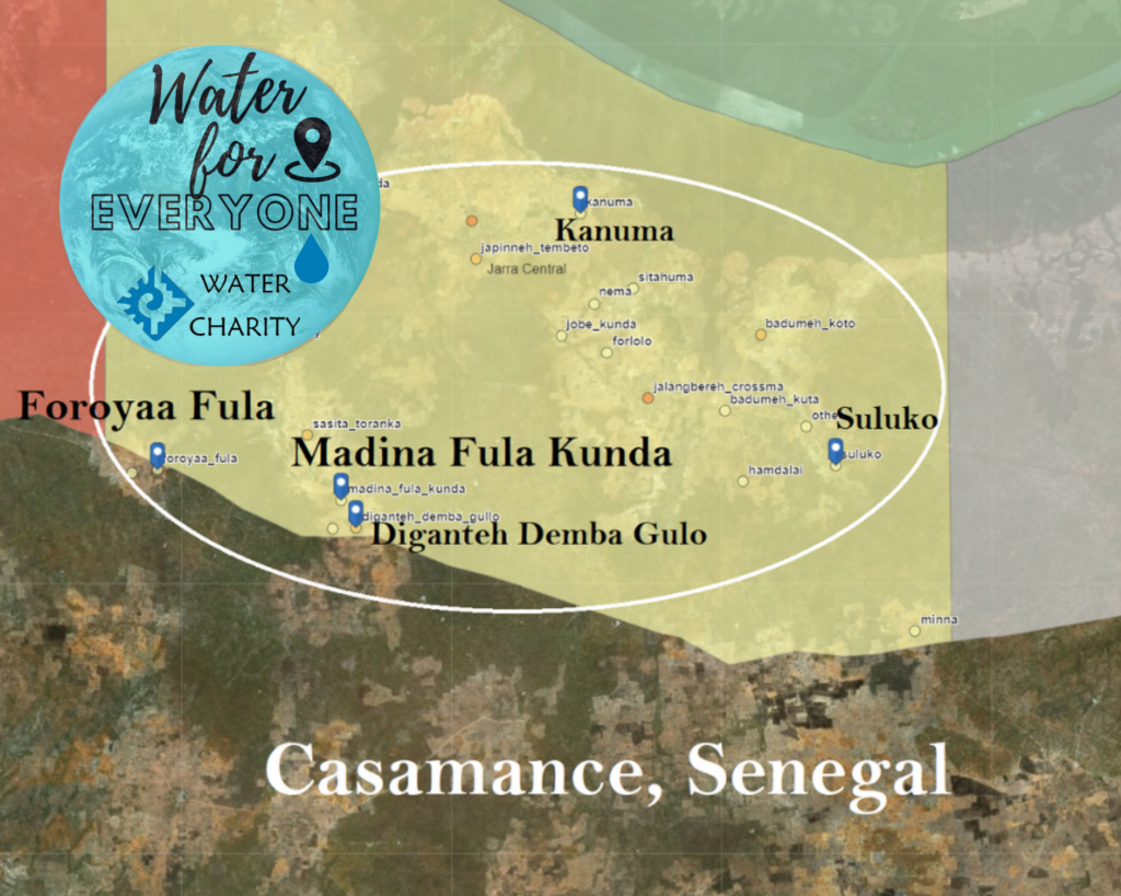
Since the 1980s, The Gambia’s Jarra Central district has continually absorbed people fleeing from social unrest in its southern neighbor, Casamance, Senegal. Cut off geographically from the rest of Senegal by the thin sliver of land that makes up The Gambia, the geographic reality of Casamance has long contributed to separatist tendencies in the province. Casamance residents blame neglect from the capital Dakar for the region’s poor infrastructure and low level of development. Calls for the region’s independence go back as far as the early days of Senegal’s emergence as an independent nation. However, the pro-independence movement was peaceful until 1982, when Senegalese security forces fired on demonstrators, triggering a violent insurgency that, officially, continues today.
Thousands have been killed and tens of thousands displaced in the fighting in Casamance, and the region’s economy has been damaged by certain features of the instability, including the use of land mines.In Casamance, 78 villages were destroyed, creating over 60,000 internally displaced people (IDPs). Tens of thousands crossed borders seeking refuge to the north in The Gambia and to the south in Guinea-Bissau.
All five of the villages selected for our Jarra Central Handpump Repair tour have experienced population growth due to the displacement of people from Senegal’s Casamance region. And, just as in Casamance itself, The Gambian government has been unable to match such population growth with commensurate development opportunities—including the efficient provision of water.
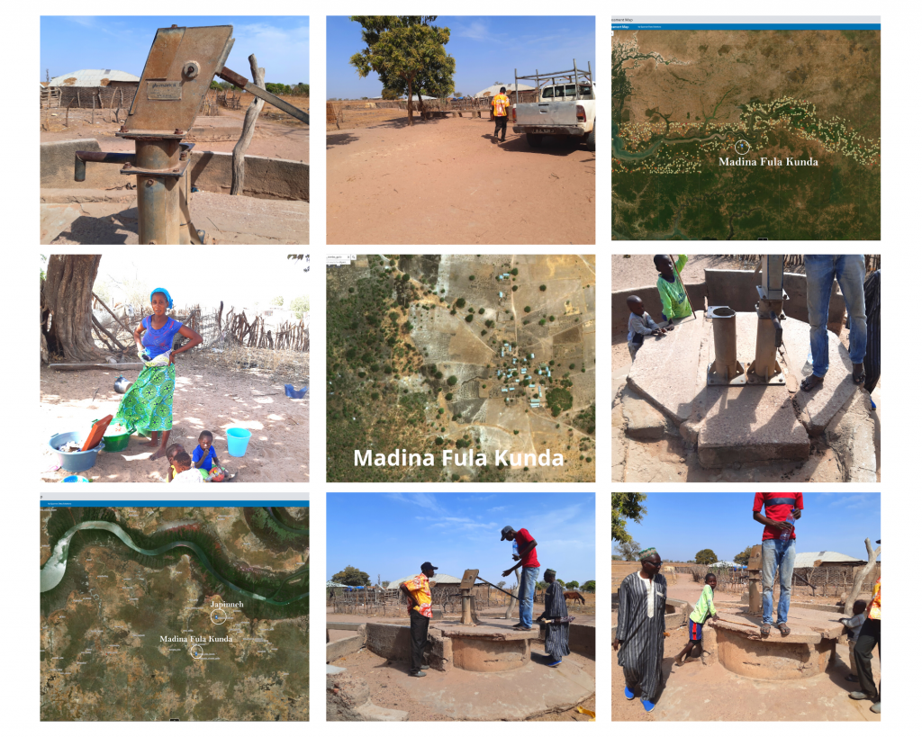
Madina Fula Kunda, Lower River Region, Jarra Central, The Gambia, West Africa; GPS Coordinates: N13°23.183 W015°26.875
DESCRIPTION OF PROJECT COMMUNITY
The village of Madina Fula Kunda is located approximately 9 kilometers southwest of Japinneh, the nearest large village on the Southbank Trans-Gambia Road. Madina Fula Kunda is populated by approximately 300 traditionally nomadic Fula tribe members. The community of mostly subsistence farmers—growing millet, groundnuts, and maize, as well as rearing cattle—has suffered from a lack of water for years. Recently, the community’s water system has completely broken down.
DESCRIPTION OF PROBLEM
The village of Madina Fula Kunda was one of many isolated communities that received a twin handpump water system from The Gambian government in the late 1980s. The government’s assumption was that a twin handpump would insulate the community from the risk of total system breakdown. For over three decades, it did. Today, however, both pumps are broken and the community must travel two kilometers away to fetch water. One year ago, the community attempted to fund the rehabilitation of one of the pumps, but because they could only afford junk parts, within months the pump broke once again.
To fix the twin handpump system, a trustworthy contractor will install two new conversion heads, one new cylinder, two new water tanks, one pedestal, one concrete slab, and some cement work to construct a trough for the watering of livestock and a safety perimeter fence to maintain water purity.
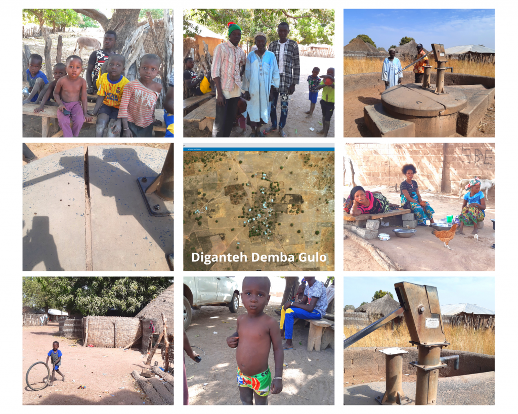
Diganteh Demba Gulo, Lower River Region, Jarra Central, The Gambia, West Africa; GPS Coordinates: N13°22.521 W015°26.419
DESCRIPTION OF PROJECT COMMUNITY
A few miles from the border with Casamance, Senegal, the village of Diganteh Demba Gulohas seen its population explode over the last four decades. Today, what was once as small farming community—one that nonetheless still subsists on groundnuts, maize, and millet—is now a village of approximately 2000 people.
DESCRIPTION OF PROBLEM
Like other isolated villages in The Gambia, Diganteh Demba Gulo was provided a twin handpump water system in the late 1980s by The Gambian government. While one of the handpumps continues to function, a community the size of Diganteh Demba Gulo needs two. A reputable contractor will replace the broken handpump’s chain, bearings, stainless steel rods, and water tank, as well as construct a cement livestock watering trough and perimeter safety fence.
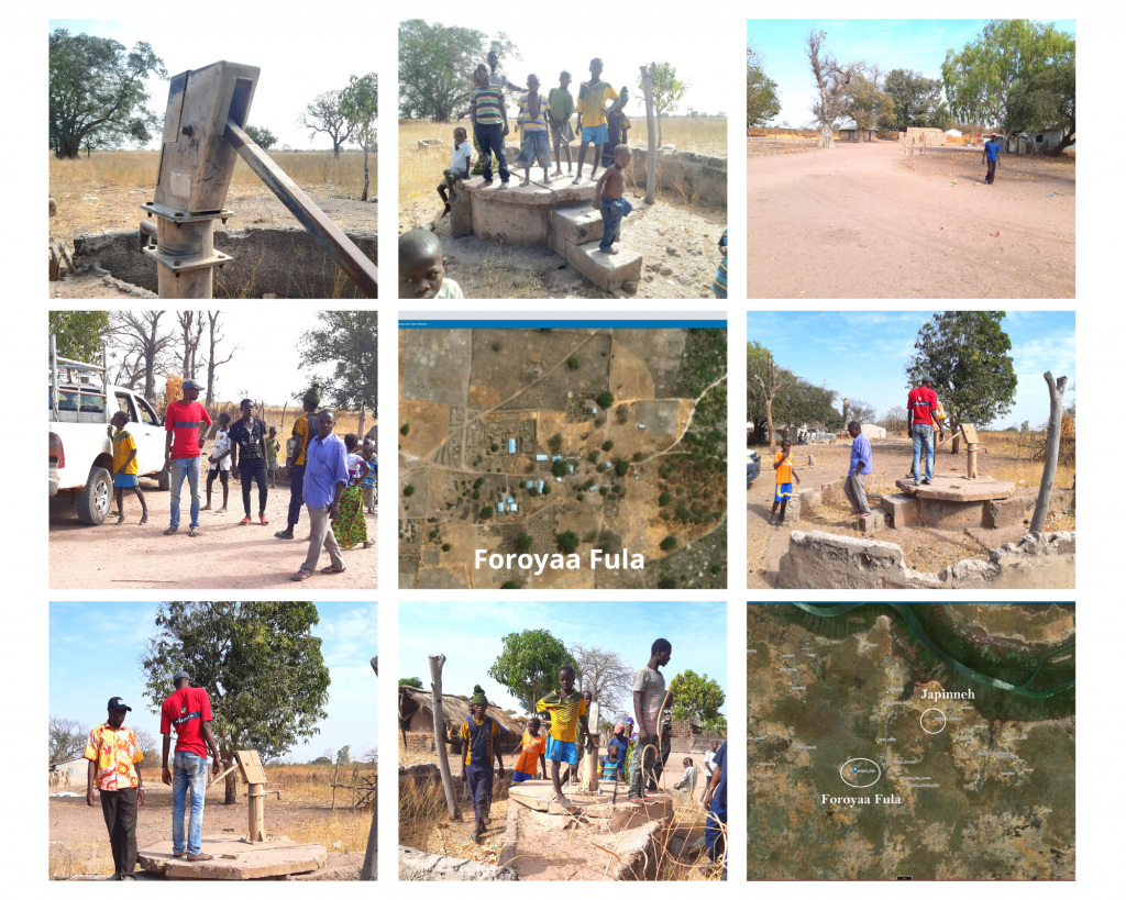
Foroyaa Fula, Lower River Region, Jarra Central, The Gambia, West Africa; GPS Coordinates: N13°23.139 W015°28.349
DESCRIPTION OF PROJECT COMMUNITY
Foroyaa Fula village is a community of approximately 300 traditionally nomadic Fula tribe members who rear cattle and depend on the subsistence farming of maize, millets, and groundnuts. The community is home to a primary school. As a result, the water from a refurbished handpump will also benefit the school, which currently enrolls 76 students.
DESCRIPTION OF PROBLEM
In the late 1980s, Foroyaa Fula was a smaller village and so received a single handpump from The Gambian government. The handpump functioned well for three decades but has been broken for almost four years now, forcing villagers to travel five kilometers to Japinnehin search of potable water.
A reputable contractor will replace and install for the single handpump: new bearings, a new chain, a new cylinder, a concrete slab, and a completely rebuilt cement trough for watering livestock without the risk of contaminating the well.
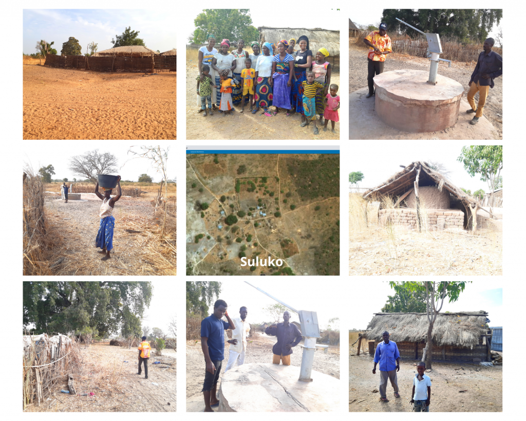
Suluko, Lower River Region, Jarra Central, The Gambia, West Africa; GPS Coordinates: N13°23.210 W015°21.788
DESCRIPTION OF PROJECT COMMUNITY
Suluko is a subsistence farming community made up of approximately 150 Fula tribe members. It is located about 2 kilometers southeast of Sara Jama, the nearest town along the Trans-Gambia Southbank road. With a recent lack of rain and the concomitant failure of their crops, the community has turned to felling local trees to make into charcoal for sale at the nearby Loumoin Bureng.
DESCRIPTION OF PROBLEM
Again, in the late 1980s, Suluko received a single handpump from The Gambian Government. Now, more than thirty years later, the single handpump needs repair. A reputable contractor will provide and install a new cylinder, a new concrete trough, and a rebuilt security fence to prevent the animals from contaminating the water source.
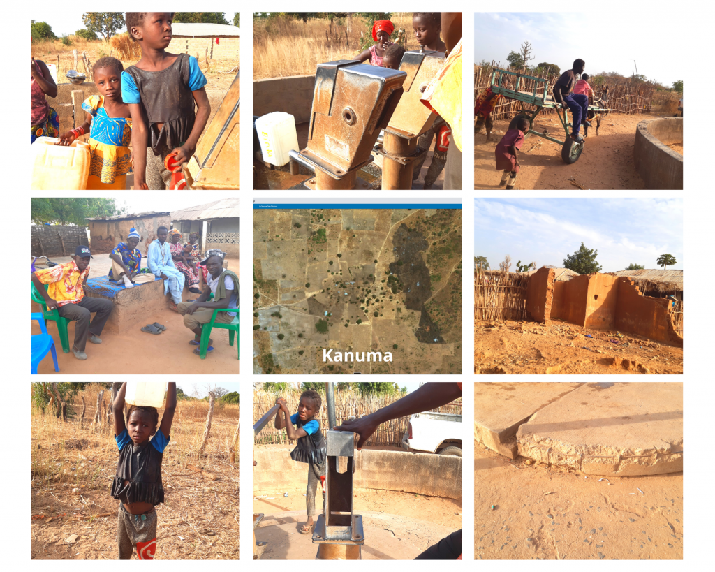
Kanuma, Lower River Region, Jarra Central, The Gambia, West Africa; GPS Coordinates: N13°25.568 W015°24.261
DESCRIPTION OF PROJECT COMMUNITY
Kanuma is the northernmost village on our Jarra Central handpump tour. The village is a Mandinka community located about 2 kilometers north of Japinneh along the Southbank Road. Most of Kanuma’scommunity members—also primarily subsistence farmers—are originally from Casamance. Kanuma used to be a small hamlet but when the crisis began in Casamance, a great number of people fled to Kanuma, where many of their relatives had already moved. Though close to Japinneh, Kanuma has its own Alkalo(village head) and regional political system. Over the last two years, the village’s growing population of 150 people has seen an influx of more than 300 disciples of a Senegalese religious guru who has settled in the village.
DESCRIPTION OF PROBLEM
Today a population of approximately 400 people are relying on an over three-decade-old twin handpump water system. The pressure on the system means that only one handpump is currently functioning. This is creating tension between the guru, along with his thirsty disciples, and the remainder of the community.
To fix the one handpump and bring the other up to working standards, a reputable contractor will provide and install two new conversion heads, one new cylinder, one new water tank, two stainless steel pipes, one pedestal, one concrete slab, cement to repair cracks and masonry cement for the construction of a livestock watering trough.

PROJECT CONCLUSION
Check out this short movie about the Jarra Central Handpump Repair & Handwashing Tour:
